Olympic Grand Loop (Deer Park Loop)
Posted by ekr on 15 Aug 2025
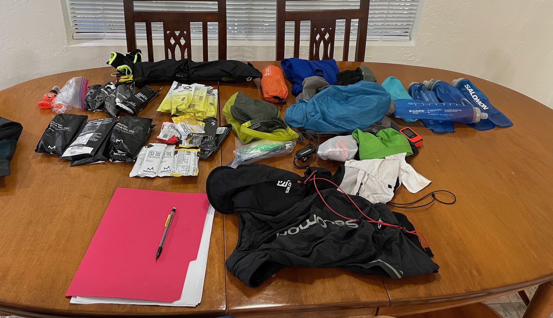
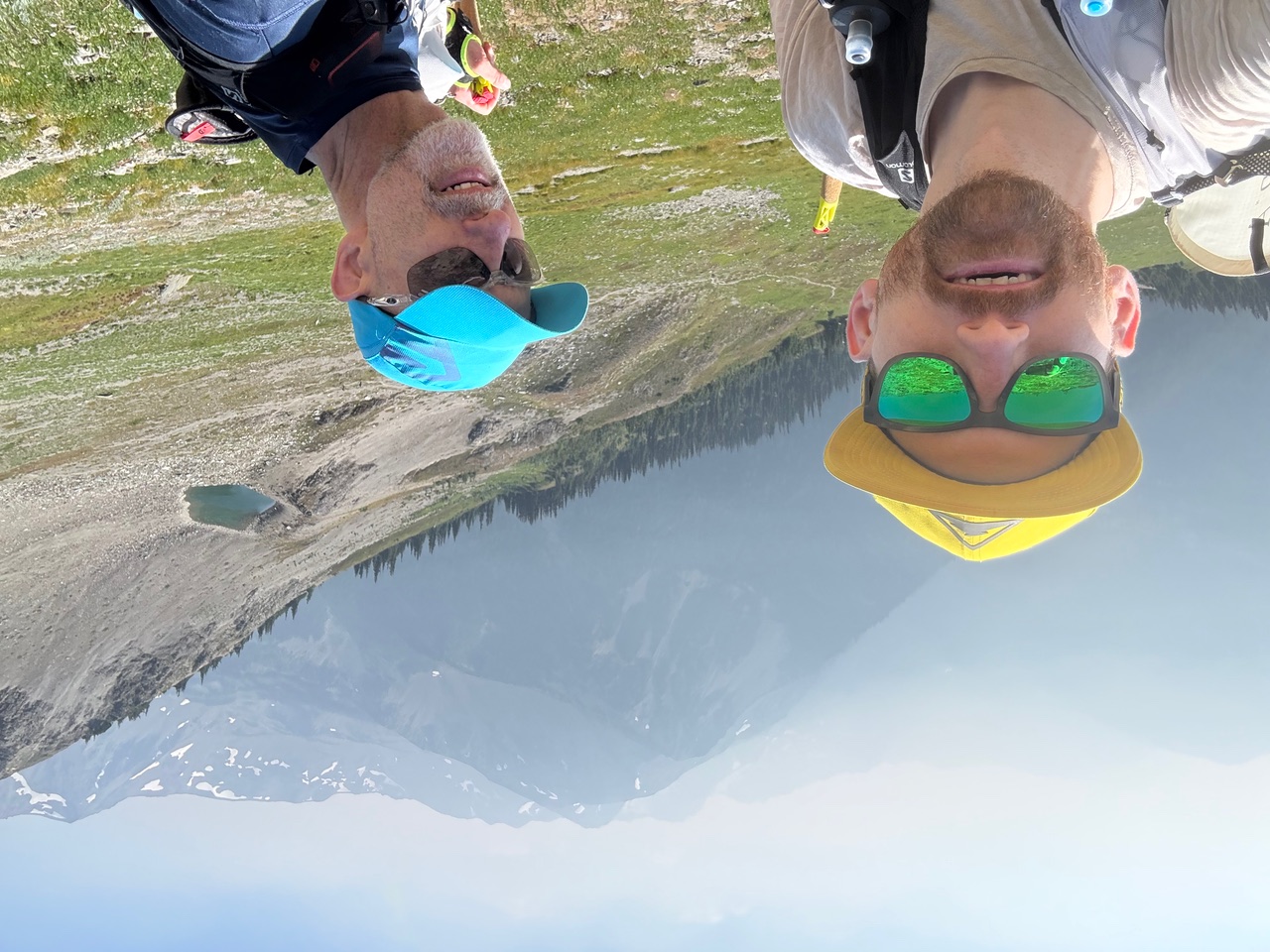
This year my occasional[1] training partner Chris Wood was selected in the UTMB lottery and asked me to come over to Chamonix and crew him. Europe is a long way to go and not race, so I looked around and finally settled on Ultra Tour Monte Rosa (UTMR). UTMR is conceptually similar to UTMB in that it's a 170K tour around a mountain in the Alps but it's about 10% more climbing than UTMB and substantially more technical, so the finish times are around 20% slower. I ran UTMB back in 2022 and finished in 37:49, so I knew I had to put in some serious training if I didn't want UTMR to be a miserable experience. I like to do some adventure runs towards the end of the training cycle both as a training tool and to test out your fitness, nutrition, etc.
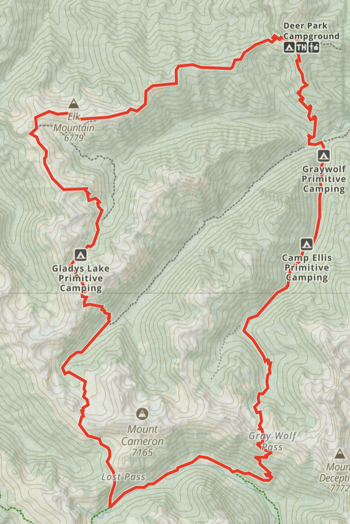
This time, Chris and I selected the Grand Loop in Olympic National Park. At 43 miles and 13000 ft, the Grand Loop is sort of like a scaled down version of UTMB/UMTR, so we figured it was good test of our fitness/final shakeout event. As well as having a lot of up and down, the climbs and descents get bigger the further along you go, culminating in a 3000 foot climb to the finish, which is good practice but still smaller than the biggest climbs at UTMR or UTMB.
The fastest known time for this route is 8:33, but Max King did it in 10:40 back in 2020, so I was kind of uncertain how long it would take us. I estimated about 15 hrs, with 14 if things went really well, and put together a food plan for a bit more than 15 but a pace chart for 14. This turned out to be fairly on.
Chris lives in New York and I live in California and so we both flew into Seattle and then drove out to Port Angeles together, staying at an AirBNB about an hour from the trailhead. Dawn was at around 5:15 and then dusk around 8:$5, so we aimed to start around 5:45.
Start Obstruction Point [8.12 mi, +2251/-1499 ft, 2:15:05, 2:15:05, 16:38/mi] #
This section went really well. It was nice and cold at the start and despite there being (in retrospect, looking at the profile), a surprising amount of climbing. Almost everything was runnable, though we decided to hike the bigger climbs to avoid going out too hard.
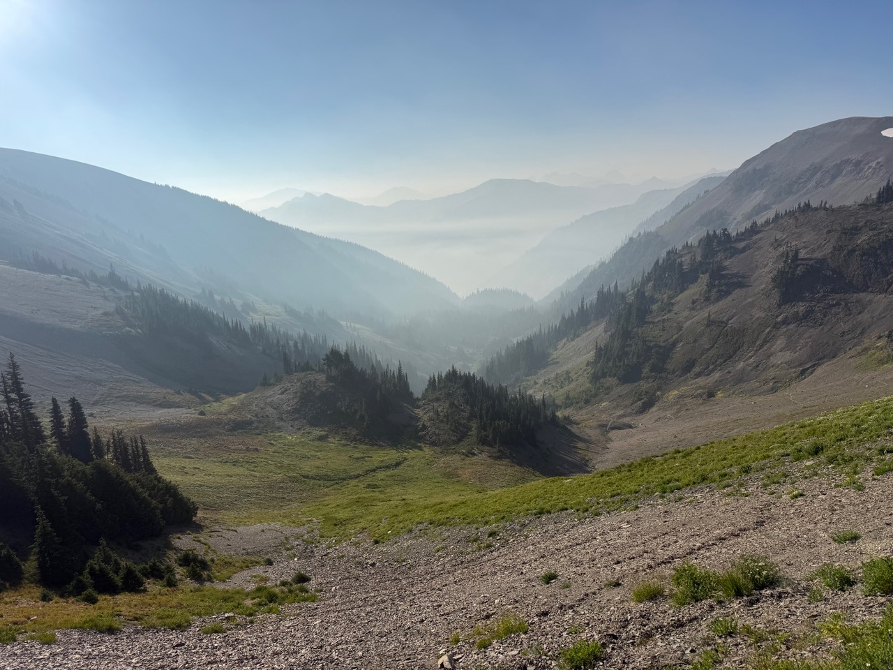
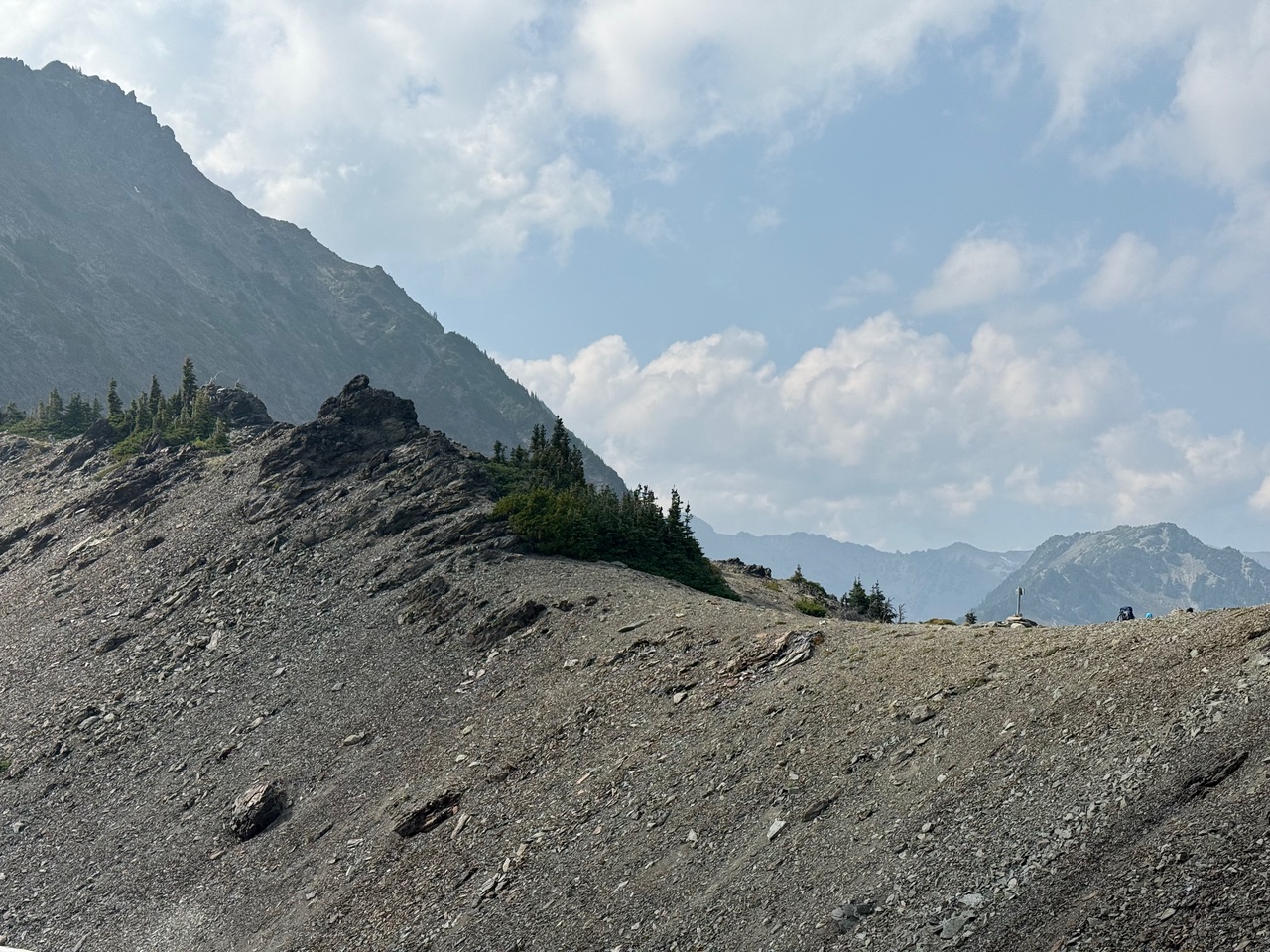
As we were traversing the ridge line, we were able to see and smell quite a bit of smoke over the valley (potentially from the Waolf Bear Gulch Fire). We hadn't checked fire conditions going in but ran into some backpackers and asked them about it and they said they were aware of it but the fire was far away, so the only issue was the smoke. To be honest, we were a bit worried about it, but after flying into Washington State, we weren't about to bail out 8 miles in.
Obstruction Point to Grand Pass [6.33 mi, +2106/-1867 ft, 2:05:53, 4:20:58, 19:53/mi] #
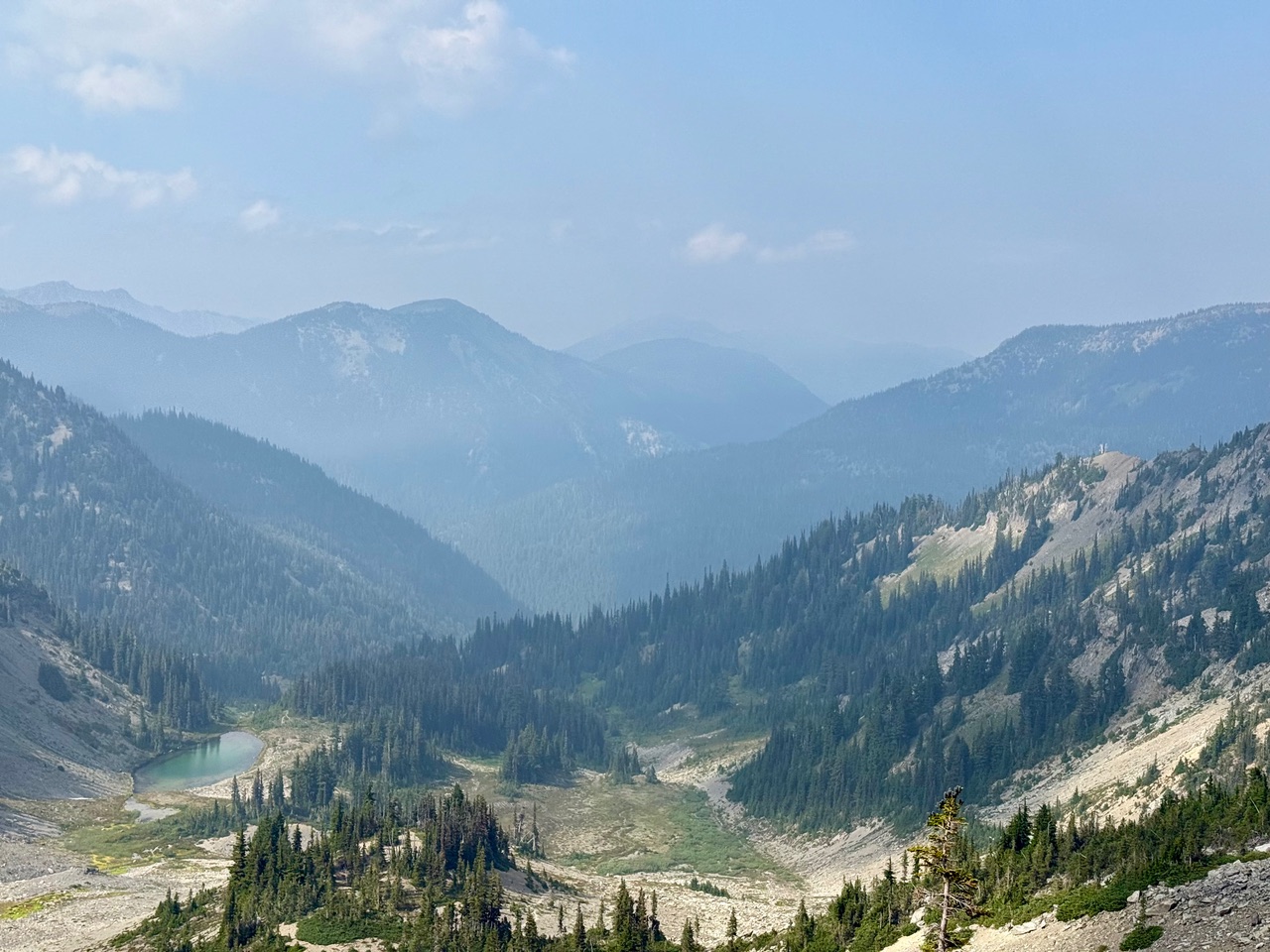
The next leg is from Obstruction Point down to Grand Lake and then up to Grand Pass. The section down to Grand Lake was still quite runnable so we took it at a good pace. Grand Lake is actually the first water source on the trail, so even though it's a bit of a detour, we went almost all the way down to the lake until we ran into a well-running stream, which works well with our gear. We are using Salomon filter bottles[2] which combine a soft flask with a filter cap attached to the drinking nipple. You can drink directly out of the flask or squeeze the bottle into another bottle. The easiest way to fill up the flask is if you have some running water which you can run right into the flask. This is by contrast to old-style pump-based water filters where you needed to have the pump intake completely submerged and so running water wasn't that convenient.[3] Of course it turns out the detour to the lake was totally unnecessary because from here on in there were a lot of stream crossings so we could have just filled up without leaving the trail.
After the lake, we had the first big climb up 1600 ft. to Grand Pass over 2.65 miles. This was a pretty straightforward climb on dirt, gravel, and scree to the top of the pass and we were still feeling nice and strong.
Grand Pass to Cameron Pass [5.34 mi, +2405/-2326 ft, 2:17:49, 6:38:57, 25:50/mi] #
This next segment is where things started to get difficult. It's listed on the map as "Cameron Pass Primitive Trail", and lives up to that reputation. The downhill from Grand Pass is quite steep (about 2000 ft over less than two miles) and technical, making it hard to run fast; then you turn around and start the long climb to the top.
Partway up this climb I started to have a bit of a low patch, feeling a bit hungry and lightheaded. I'd been sticking to my nutrition schedule but it had mostly been liquid calories and also I'd substituted sports drink for water a few times when I filled my bottles, so I think I just got a little behind and my stomach was empty. I swapped in some solid food and loaded up on salt and quickly started to feel better. This was the only time I actually had any real trouble on the entire route, and I felt pretty solid from here on in.
At this point we'd given back pretty much all of the time we made up in the first leg and we're right on the projected schedule for 14 hrs, but of course the terrain didn't get much better, so we just kept falling further behind.
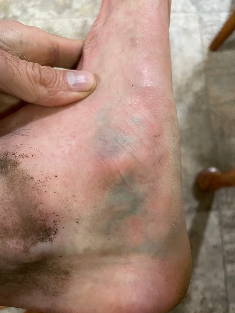
At this point my feet were starting to hurt some, especially in my ankles. Nothing too bad, but a little concerning at 20 odd miles in.
Cameron Pass to Gray Wolf Pass [9.61 mi, +2867/-3150 ft, 3:49:45, 10:28:42, 23:55/mi] #
This next section was really more of the same: a long descent down to the valley floor followed by a climb to Gray Wolf Pass. The footing didn't really get much better from here, so we were doing quite a bit of walking even on the downhill. This section didn't seem too bad in terms of smoke but there must have been some because it seemed to trigger my asthma and I found myself coughing a bit.
We hit the bottom of the trail to Gray Wolf Pass and each took our first Maurten GEL CAF to give us some energy on the way up. The climb to the top of Gray Wolf is surprisingly long, and you can see the peak from a long way up. The top mile or two is just on exposed rock and sand, so there was a bit of "can it really be another half mile", but eventually we hit the top. There were a few backpackers sitting at the top eating. We chatted with them and got the usual "are you really doing it one day, wow", response, and then it was time to head down.
Gray Wolf Pass to Three Forks Climb [9.31 mi, +66/-4068 ft, 2:58:40, 13:27:22, 19:11/mi] #
By this point we were definitely starting to run behind and we didn't think we'd see 14 hrs, but we were expecting to pick up some time on the 9 mile downhill and finish in the mid 14s. Unfortunately, this part of the trail was really not that runnable at all. Coming off the ridge it was the usual sand, gravel, and loose rock so we didn't go too fast and then once we got to lower altitudes it was a lot of rocks and roots, as well as stream crossings, mostly in the form of narrow. There were also a lot of treefalls we had to climb over or under, though at least the trail was clear so we didn't have trouble finding it once we got past the treefall.
This section had quite a few stream crossings, but unlike many backcountry trails, they were really well maintained, with actual bridges. Most of these were just a single log that had been flattened on top, so you had to watch your balance. I found myself thinking about my friend Cullen, who used to say that it's easy to walk a foot-wide path that's on the ground, but if you put a a foot-wide plank 50 feet in the air, very few people can do it. A few actually had a railing, which made life a lot easier. Either way, though, it's a lot better than having to hop across a bunch of rocks.
As a result of all this, we had a really hard time getting into a a rhythm; we'd run a little and then have to walk, then run some more, etc. This made for a really long 9 miles where you had to be constantly paying attention to make sure you didn't trip, and I found myself repeatedly looking at my watch to see if we were finally close to the part where we could start climbing.
Three Forks Climb to Finish [4.71 mi, +3222/-13 ft, 1:47:30, 15:14:52, 22:50/mi] #
Finally, we made it to the bottom, popped another GEL CAF and started up the Three Forks climb. This was the biggest climb of the day but also one of the nicest parts, consisting of nice smooth shaded single track. Of course it didn't hurt that we knew this was the last thing we had to do. By this point my feet had started to feel quite a bit better, probably from the easier trail.
We made pretty good time up the climb: 22:50/mile isn't bad at all for a 13% grade. Poles really help a lot under these conditions: you don't need them for stabilization but they let you recruit more of your body to drive you up the hill. It's just a matter of putting your head down and keeping moving.
About 1/3 of the mile from the top were rewarded with the trail opening up into a flat runnable section that took us all the way into the finish. Even though we had been pushing up the climb we still had plenty of gas in our legs and were able to finish nice and strong.
Retrospective #
Overall this outing went fairly well. This is a really beautiful route that is simultaneously tough but also doable in a single day without feeling too wrecked. The climbs are definitely long, especially towards the end, but unlike some other mountain routes I've seen there's nothing where you're just death marching in the heat. It really helps that there's plenty of water all along the route except for the first 12 miles to Grand Lake, but that section goes really fast. After that, there were a few places we got low and were a little worried about water availability, but never so much that we got desperate; it was more a matter of convenience and quality of the source, as in "should we fill up at this marginal stream or wait for something better?"
We finished on the high side of my forecasts but I was more or less guessing anyway and 40 odd percent slower than Max King isn't too shabby. Reading their FKT report, it seems like they also had a really fast leg to Obstruction Point and then slowed down a lot as well.
Nutrition went well. I've been experimenting with liquid-only nutrition (Maurten 320 and Tailwind High Carb) but on previous outings I started not to feel that great, which is consistent with how I felt here. This time I alternated Maurten 160, Maurten 320, and Tailwind High Carb and ate solid food when I was drinking Maurten 160 and water. This seemed to work pretty well, but I think in the future I may try to do more like Maurten 160 half the time rather than about a third.
Except for a few brief periods I already mentioned, I felt good essentially the whole way and not too wiped out at the end. I was pleased to be able to run comfortably for the last bit. Next up, Chamonix and Grächen.
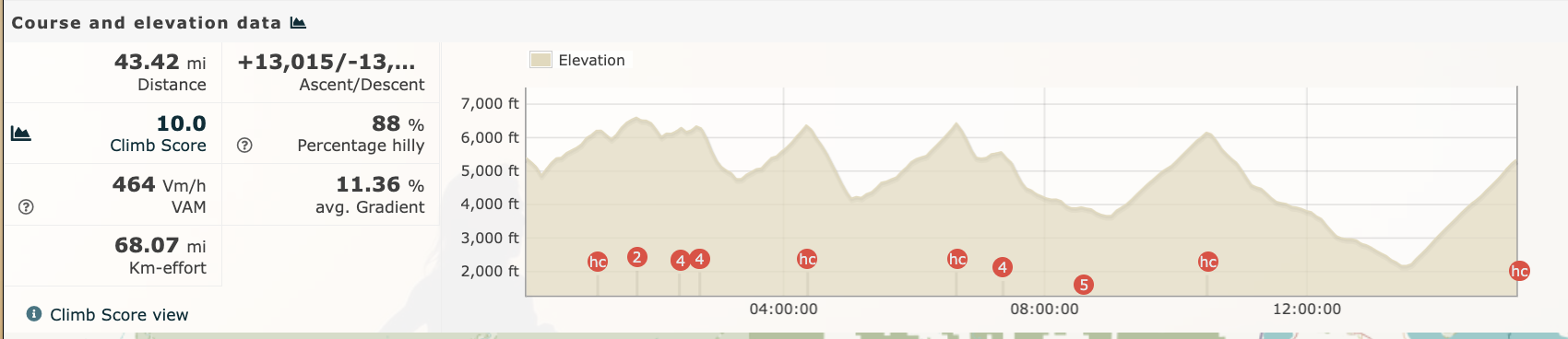
Overall 43.4 mi, 13015 ft, 15:14:52, 21:04/mi.
He moved to NYC! ↩︎
Hydrapak and Katadyn sell filter caps which are basically the same. ↩︎
This is actually the result of some cool new technology. Older filters use either a paper or a ceramic filter and require quite a bit of pressure to drive the water through. Newer filters are based on hollow fiber membranes, which require a lot less water pressure. Instead of a pump you can just have a flexible bag and squeeze the water through the filter or even use a gravity feed. ↩︎