Desolation Wilderness Seven^H^H^H^H^HTwo Summits
It's possible for the weather to be a bit too exciting
Posted by ekr on 05 Sep 2023
My two races this season were to be Broken Arrow Skyrace and then a hundred to be named later. I'd originally planned to do Whistler Alpine Meadows 100 but then it was cancelled in February and I spent a long time procrastinating but finally settled on Teanaway Country 100. Teanaway is about the opposite of UTMB: a tiny low-key race (59 entrants so far), but with pretty similar topline stats, with 32000 feet over 100 miles.
I've had several solid training blocks this year, but I wanted to try to get in one more adventure run this summer. Unfortunately, due to last winter's ridiculous snow season, most of the routes I was interested in doing in the Sierra were snowed in in midsummer, so I didn't start looking seriously till a few weeks ago, eventually deciding to take a crack at the Desolation Wilderness Seven Summits Loop, which I first saw on Leor Pantilat's fantastic site. As the name suggests, this route covers the seven named summits in the Desolation Wilderness. Technically speaking, the fastest known time for this is just to hit the peaks however, but there's a common loop linked above. The loop is 29 miles long with 10000+ ft of climbing including a fair amount of off-trail terrain, so I figured it would be a nice scaled down warmup for Teanaway. I'd actually intended to do a slightly longer variant of about 40 miles/15kft the week of August 13, but then I got sick and so had to defer to last weekend, and with only two weeks to Teanaway, decided to stick to the normal version.
Logistics #
This loop starts at a parking lot off US 50 en route to Tahoe a bit East of Kyburz. I stayed at the Sierra Inn On the River, which is conveniently situated about 15 minutes away. I was planning to start at about 5:30-6 AM (sunrise is at about 6:40), so I was able to sleep in till 4:30 and then drive over.
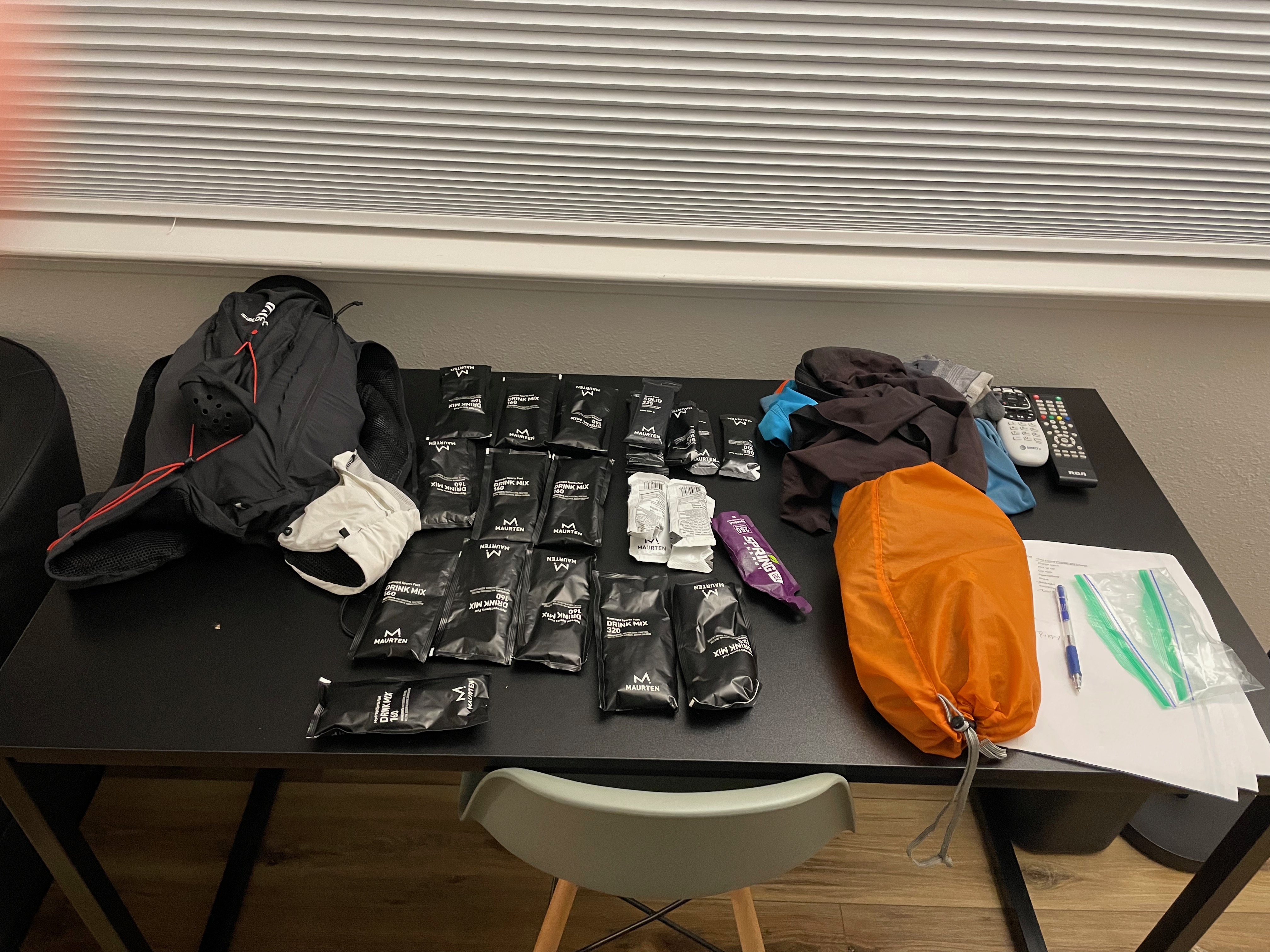
My stuff laid out for the next day. I ended up not bringing the remote control.
Desolation Wilderness requires permits which are self-issued at the trailhead—overnight stays require a separate permit—but even though the parking lot is at an official trailhead, I was unpleasantly surprised to see that there wasn't any kind of kiosk either at this trailhead or on the trailhead on the other side of the highway. This actually isn't the trailhead you enter the Wilderness from; instead you run down the highway for a few miles, so I figured I'd just head out and hope there was a kiosk at the other trailhead.
Start to Trailhead [3.3 mi, +249ft/-774ft] #
The first two miles or so is downhill on 50, and even though it was starting to get lighter, I did this on headlamp (Petzl Actik Core), both to make sure of my own footing and for visibility. I took this pretty easy at 8:15/mile so I could warm up.
There was no bathroom at the start, and predictably I'd only run a mile or so before I really needed to go. Fortunately, the Pyramid Creek trailhead is right along the highway and has flush toilets. They also have a pay parking lot but still no place to issue your own permit. I walked to the start of the trailhead and found a sign saying that there was permit issuance at the Wilderness boundary about a quarter mile up, so I went down the trail a bit hoping to find it, but despite going past the sign for the boundary and up to the top of a little ridge, I never found it and just gave up and headed back down the road. I did manage to lose my sunglasses, though, not, as it turned out, that I needed them.
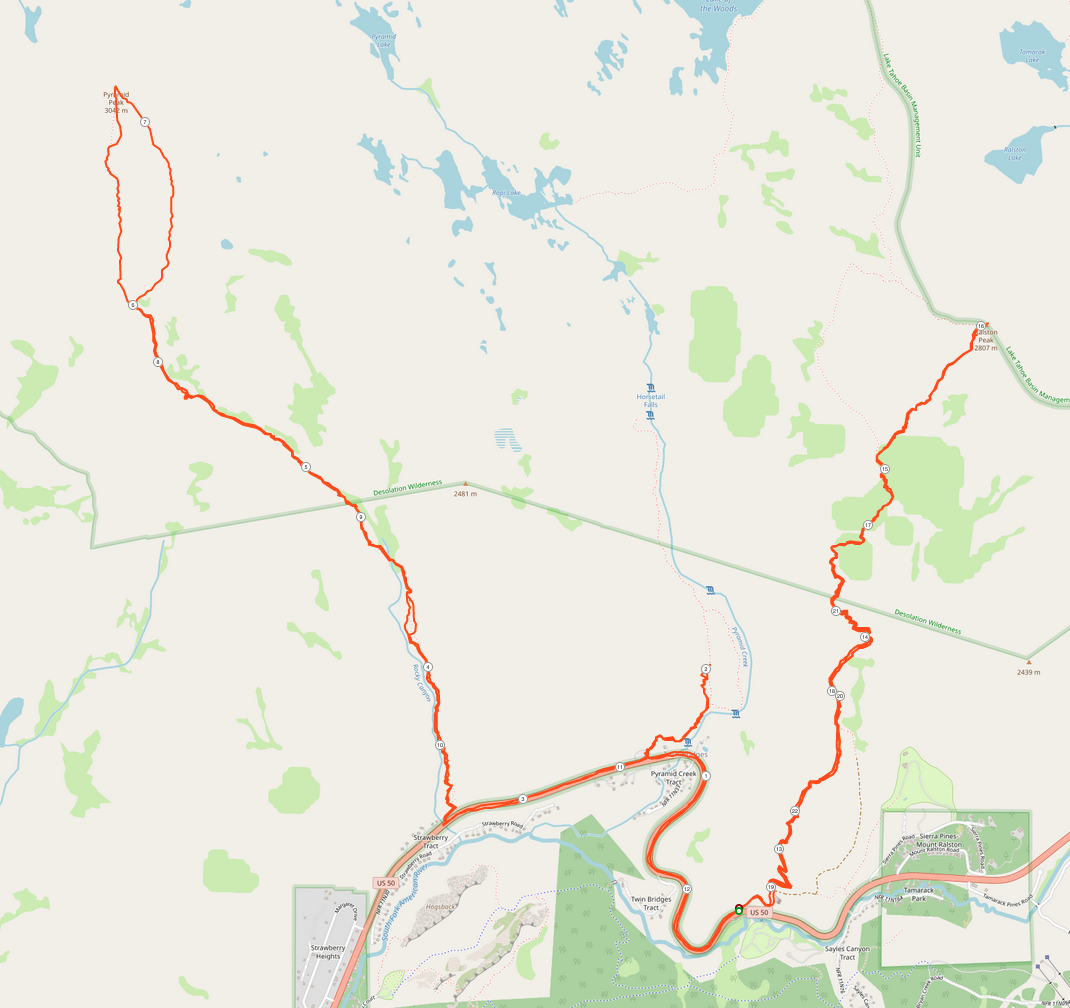
Pyramid Peak Trail 10.33 [7.03 mi, +4262ft/-4196ft] #
This route involves a climb to the top of Pyramid Peak followed by a bunch of traversing of the high country, tagging the rest of the peaks, and then a descent to the bottom. The Pyramid Peak Trail doesn't actually have a real official trailhead, so much as a small parking area across the highway from a cut-out in the embankment. There were two cars there already and apparently it gets full later, but as I was on foot, it wasn't a problem for me.
The first summit is a monster climb right from the start, ascending almost 4000 feet in 3.3 miles. I didn't even bother to try to run any of it, but just pulled out my poles and started hiking. This is kind of an unofficial trail and isn't really marked but is in OK shape and so I was mostly just able to follow the tread pattern, occasionally checking the GPS to make sure I was on the right route.
The footing is pretty reasonable but it's still slow going because it's so steep. It also was starting to get windy so I decided to throw on my rain jacket. I have the Inov-8 Raceshell half-zip and I bought a size up with the idea that I could put it on over my pack so that you can get it on and off quickly, but this works a lot better in theory than practice, as it's a pullover and gets caught on the bulge of the pack, so I fought with it for a few minutes and then finally just took my pack off. The jacket is comfortable and breathes well, though.
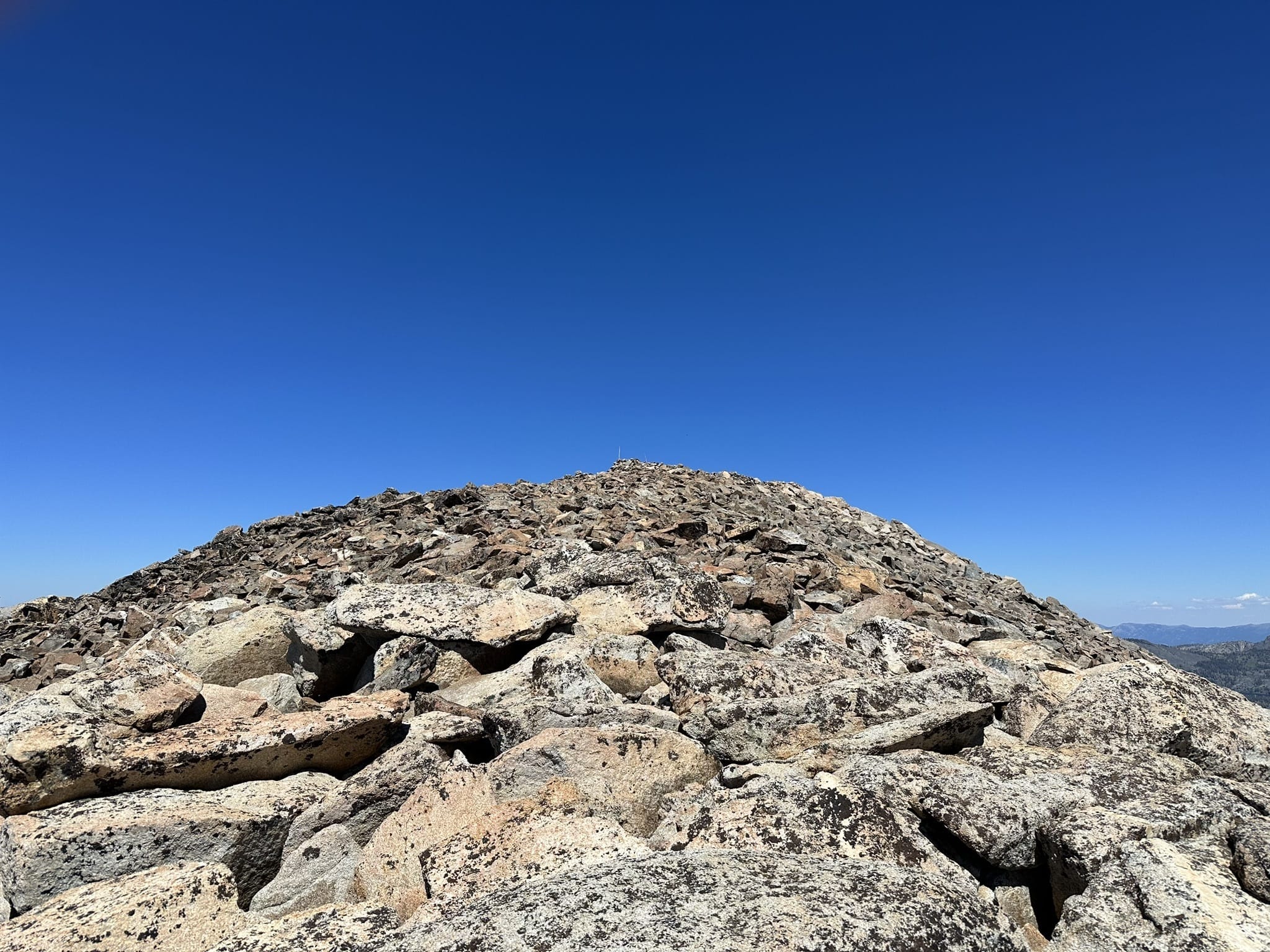
Eventually, the trail just kind of ends and you get to the final 500ft or so of climb, which are just one giant talus pyramid. I forgot to take a photo here, but this shot gives the idea:
[Source: Charles Jenkins]
There didn't seem to be any obvious trail up to the top, so I just started to scramble up. As I was doing so, I saw what looked like a runner at the top starting to come down and then I ran into two hikers. They told me that it was really windy at the top (it was already quite windy where I was) and that it was safer to stay towards the right (the way they had come down). I followed their advice and sure enough it started to get quite bad to the point where I wasn't that comfortable just standing up and had to use my hands more than usual. This last 500 feet of climbing and maybe a half mile probably took me like 30+ minutes and I almost turned back once because it was so sketchy.
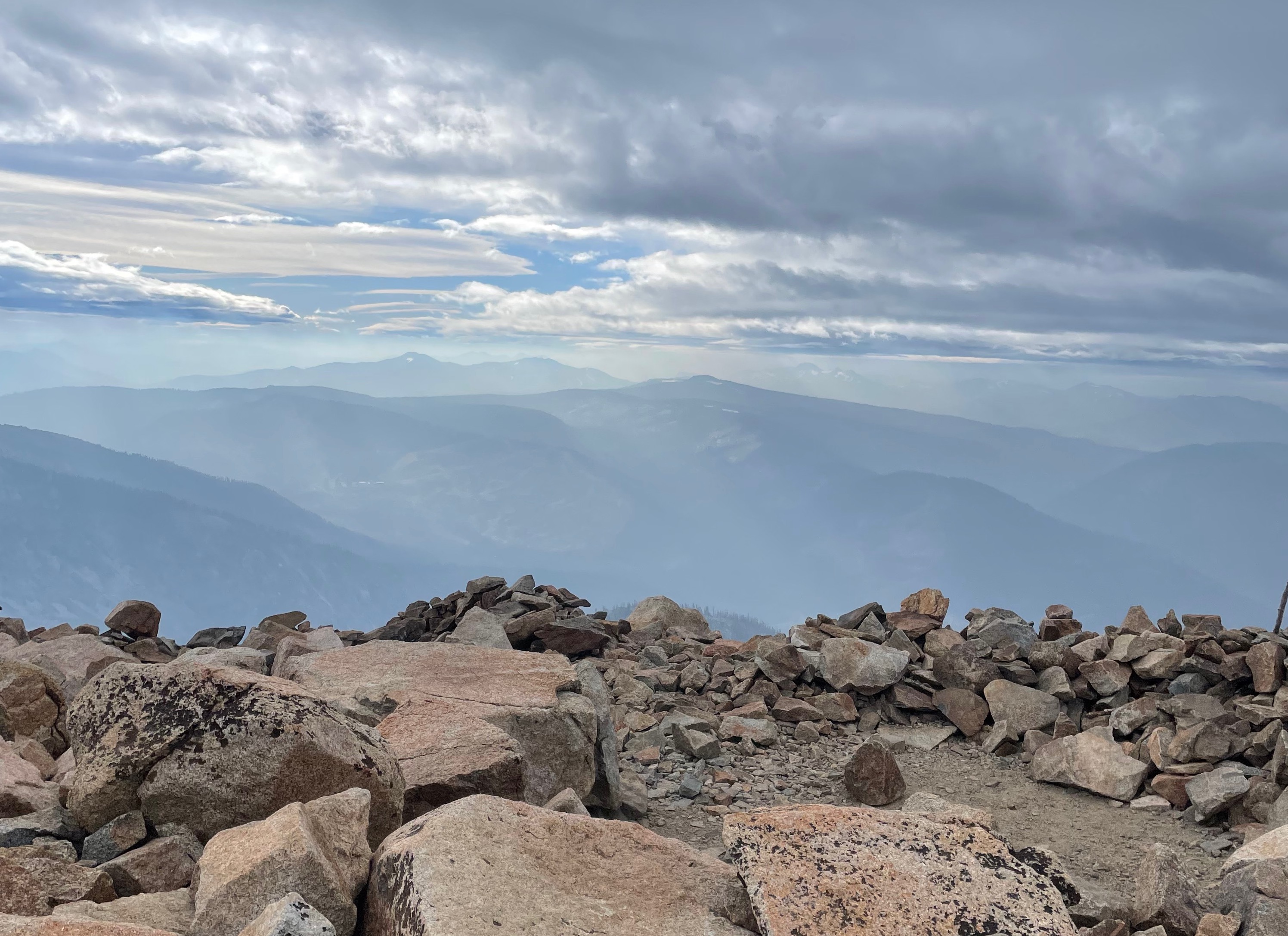
I finally made it to the top and found somewhere that was a little sheltered and managed to take some photos. I didn't really want to stand too much on the rock ledges surrounding the hollows people had opened up at the top (presumably for shelter), and it wasn't really that clear, but there are still some great views.
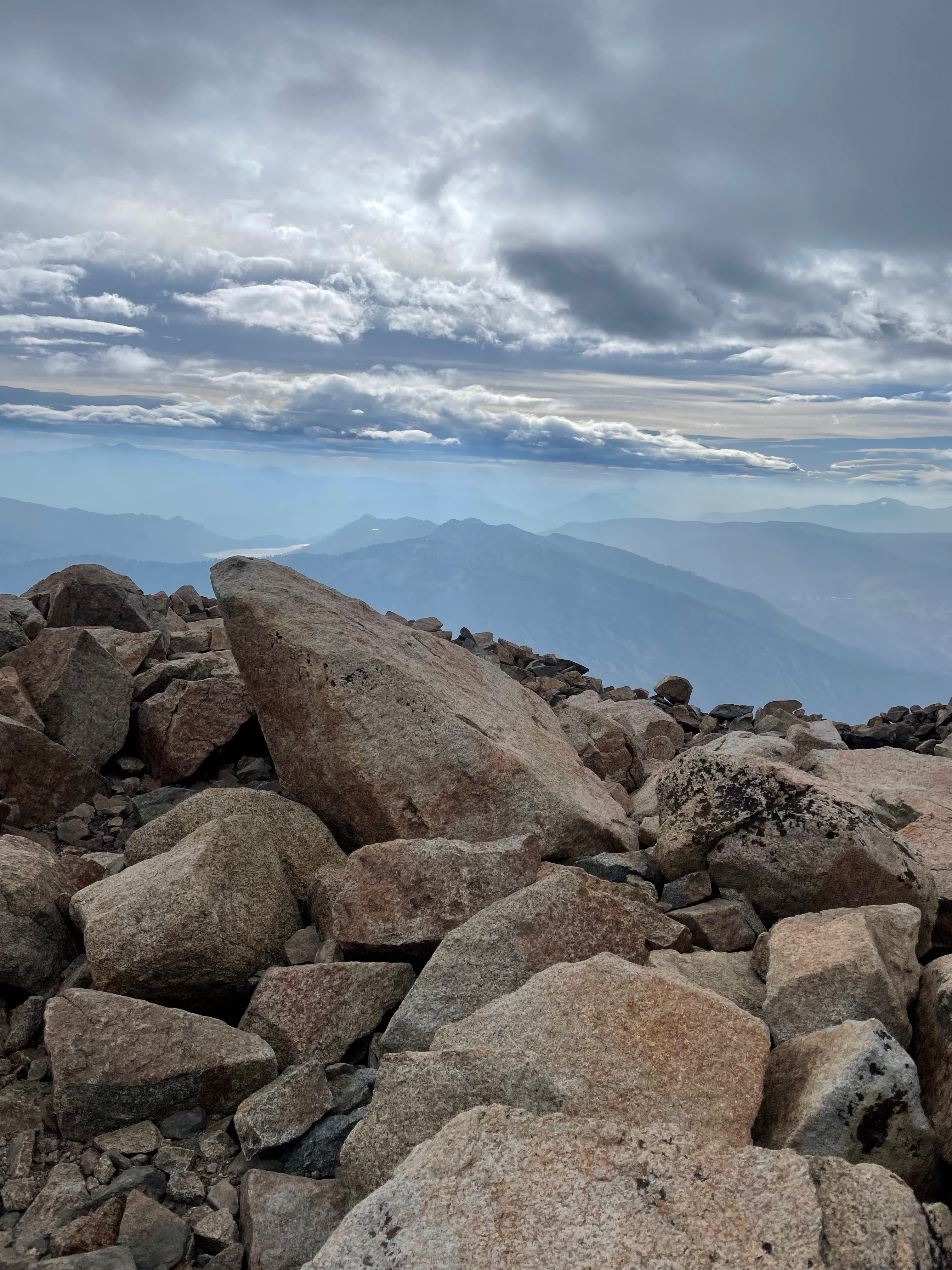
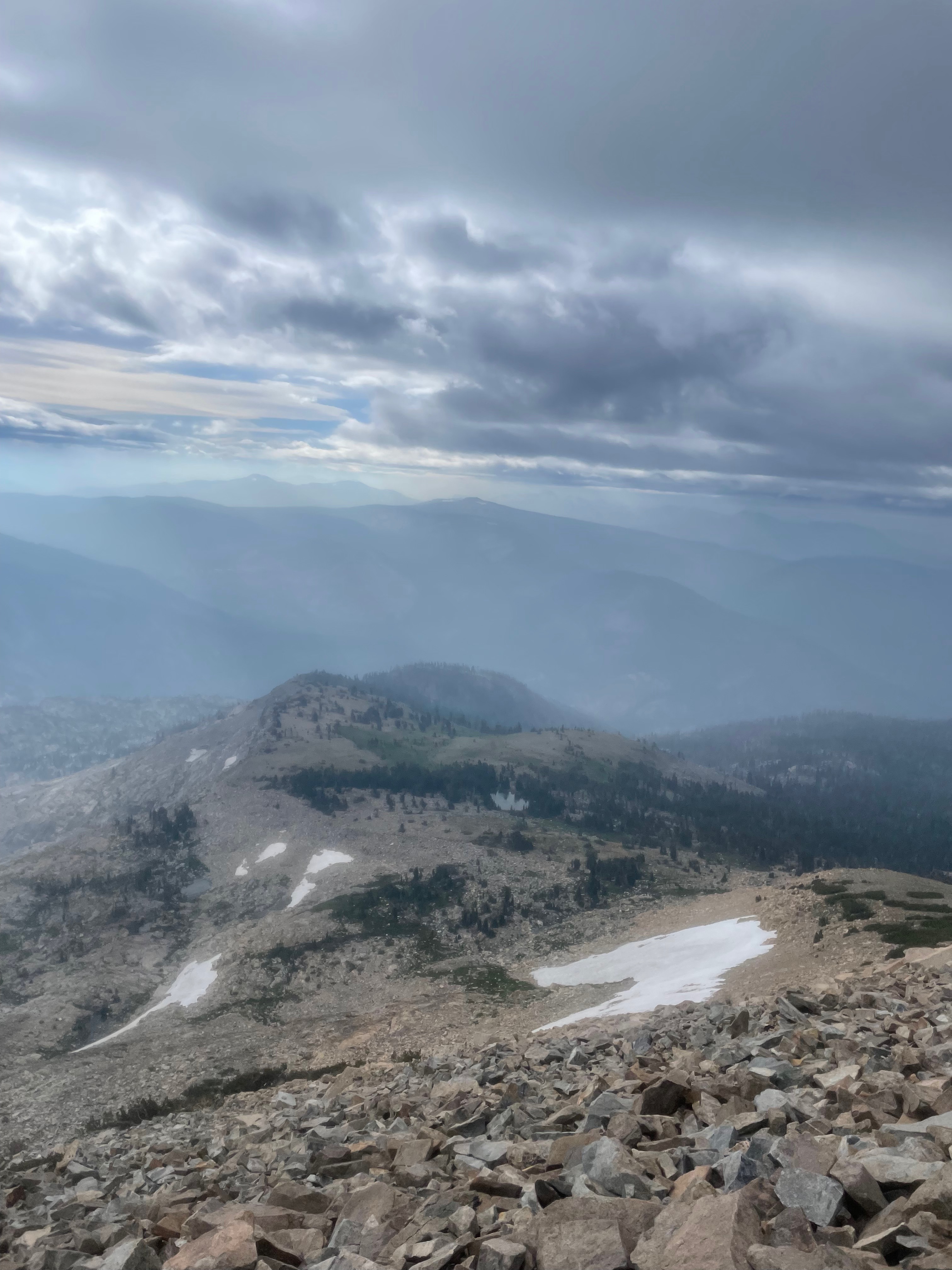
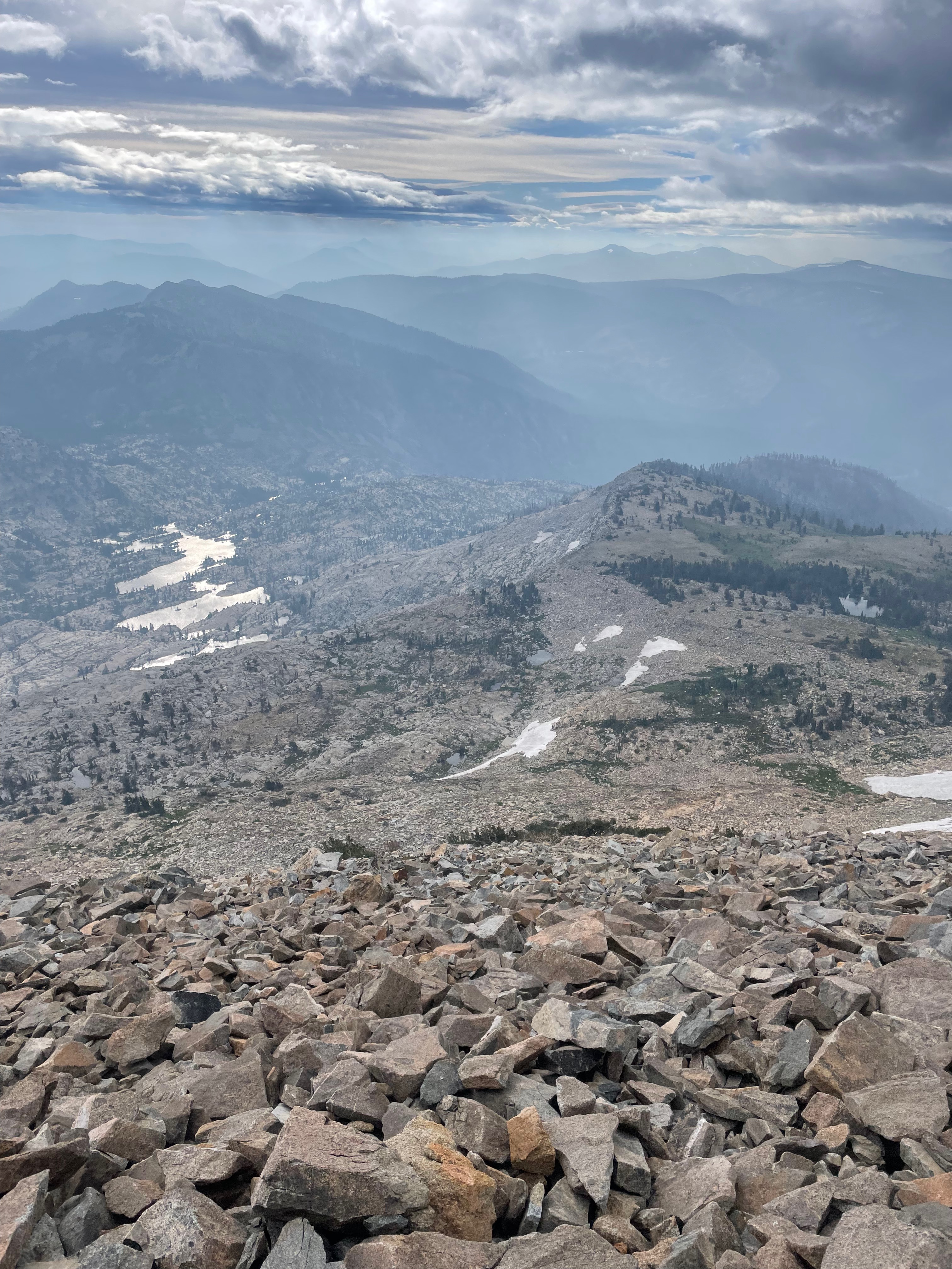
This last one really lets you see the rock slope you have to descend. Sketchy!
At this point, you're supposed to head down the back side of Pyramid Peak and head offtrail to Aggasiz Peak, but when I looked down it was pretty unclear where the trail was and I really wasn't thrilled about the idea of being exposed to that much wind for the next 10 or so miles, so I made the—in retrospect correct—decision to turn back.
As is commonly the case, coming down that rockpile was actually worse than going up: you've got gravity trying to pull you down and because you're facing forward, you can't really use your hands, so I slipped and fell on my ass a bunch of times. Because I was trying to stay out of the wind I veered way off course and ended up kind of skirting the edge of the peak and then had to bushwhack my way back to the trail. From there it was a pretty straightforward descent to the bottom and I was able to run a fair bit of it.
Back to the Car 12.24 [1.91 mi, +443ft/-39ft] #
From the bottom, I needed to climb another 500 feet or so on 50 to get back to the car, which gave me some time to regroup. At this point I was about 11 miles (though 4000+ ft) and 5 hrs in, so I had plenty of time and even though the whole route was out of the question it seemed silly to drive all the way here for what was basically a medium long run. I decided the right thing to do was to head up the trail in the opposite direction to Ralston Peak. By this point I had gone through most of my fluid, so I stopped off at the Pyramid Creek parking lot to use the bathroom and refill my bottles (I didn't have extra water in my car). From there, it's an easy run back to the car.
One nice thing about doing the route this way is that your car is a sort of impromptu aid station, so I decided to change my shoes. I do most of my running in Salomon Sense Ride 5s, but I started the day in a pair of Salomon S/LAB Ultra 3s (what I used for UTMB). I like Ultra 3s but when I put them on for the first time in months on Friday morning I didn't feel like they were giving me quite as much support as I wanted I was kind of disappointed in the traction I was getting on the loose rock, so I decided to swap them for the Sense Rides, in part so I could compare them back to back on similar terrain.
I was also starting to get a bit of a hot spot on my right heel was starting to hurt and sure enough when I took my sock off, I had a blister that had formed and popped. There's only one thing you can really do at that point, which is to tape it up, and fortunately I had some strips of kinesio tape, so I slapped one on, carefully pulled my sock back over it so it didn't peel off, and put the Sense Rides on.
By this time it had really started to rain so I swapped out my wind pants (warmish but not waterproof) for a pair of Raidlight rain pants (the old version of these). I also grabbed my waterproof mittens which go on nicely over my regular gloves. With that, I was ready to head up to Ralston Peak.
Ralston I [6.86 mi +3159ft/-2943ft] #
The Ralston climb is pretty straightforward: 2700ish feet up over a bit more than three miles. It starts out as fire road but you quickly come to a single track trail marking the wilderness boundary, where I also found a kiosk for you to register for a permit (finally). I took a moment to do that and headed up.
The climb to Ralston is a lot easier than Pyramid. The footing is about the same, except for the top, but it's only about 900fpm rather than 1300, and that makes a big difference. Of course, that's in equivalent conditions and by now it was really starting to rain and I was getting pretty cold. Starting from the bottom when I was in a rain jacket alone, I gradually ended up in glove liners, rain gloves, and rain pants, and I would have put on my arm warmers too but I wasn't able to get them on under my rain jacket (because of the cuffs) and wasn't willing to take the jacket off in order to put then on.

Partway up Ralston right after I put my pants on. Not quite above the treeline
The trail situation is a little confusing as there is a spur trail to the top but also a trail that bypasses the peak, and it appears that when Leor Pantilat did this he actually went cross-country. I opted for the spur trail, which is still pretty passable, with only a bit of climbing over rocks at the very end.
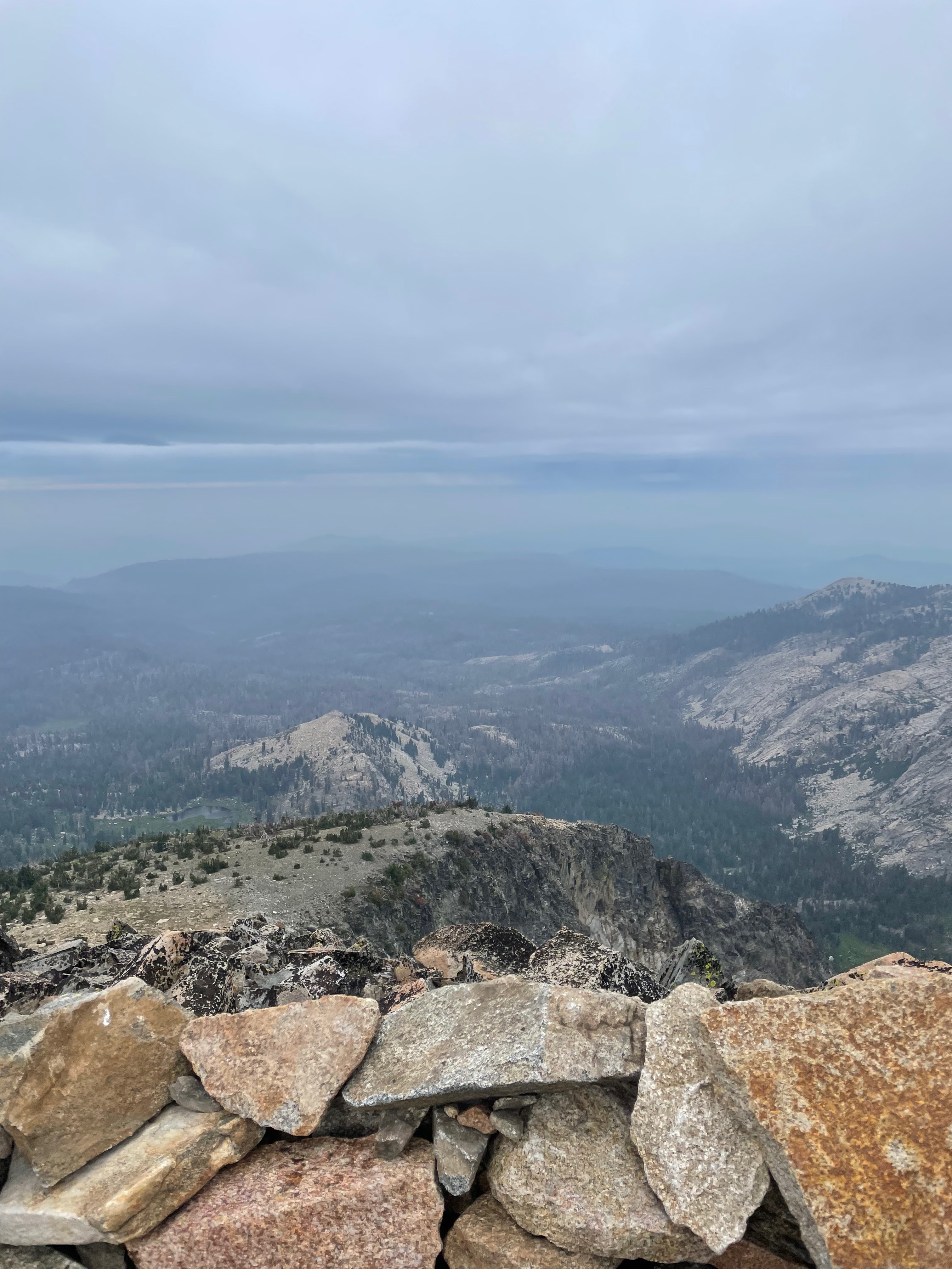
Even with all this stuff on, and working hard, I was starting to get cold as I got near the top and it got windier. A lot windier, though not as windy as Pyramid. I don't have any pictures from the summit however, or rather, I have this:
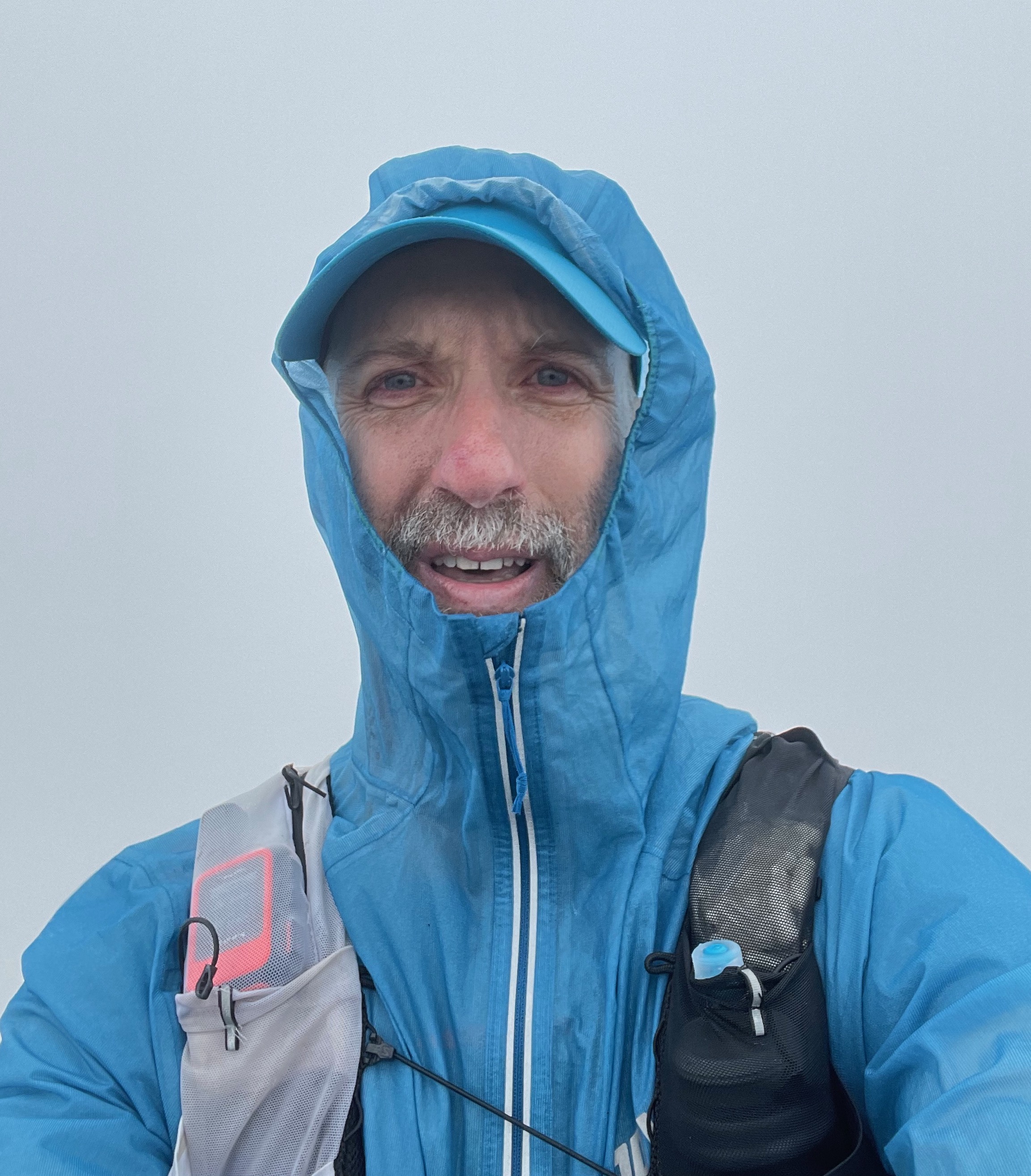
Me on the summit of Ralston Peak. You can get a sense of the wind in this clip.
This isn't really white out conditions in that you can see around you just fine at least to see the trail in front of you, etc; it's just that I'm at the top of a mountain and so everything you would otherwise be able to see is miles away and visibility is a lot less than that.
The run down is pretty easy: it's steep but good footing and as soon as you got off the peak there was more wind cover and I started to warm up again. By the time I was close to the bottom I was closing in on 19 miles and 7500 ft and runner brain took over and I started to think "maybe I should do just a bit more", so I decided to turn around at the wilderness boundary and go up "some of the way".
Ralston II [3.59 mi, +1207ft/-1348ft] #
My original plan was just to go up about .5 miles to make it a round 20 miles, but as I started to get closer to the turnaround I was like "maybe 21", then "maybe 22", and finally "maybe 9000 ft total". All this seemed fine and then my GPS started to act up and was getting stuck at a given elevation before jumping 50-100 feet. 9000 feet did come eventually at about 1.8 miles, and so I turned around and headed down, somewhat regretfully, as I was feeling quite good, but two factors pushed me to play it safe: (1) I had to race a hundred in two weeks and I really didn't want to dig myself too deep a hole (2) that it was still going to be cold and rainy at the top and I didn't want to take a chance on getting hypothermic.
I made it down to the car with no issues. As before, this isn't super fast terrain and I didn't want to fall, so I just took it easy and focused on my footing. It was still raining pretty hard, so then I got the fun of having to get out of my wet clothes while trying to stay modestly dry. As usual, by the time I had my clothes on I was super cold and had to run the heater on full for the next hour or so of the drive back, but otherwise I felt fine.
Nutrition #
I did this all on Maurten, which is what I plan to mostly use for Teanaway, as my stomach can be a bit finicky and I've found Maurten works pretty well. This was a lot intensity effort which is easier on your stomach, but I never really felt any stomach distress.
The table below shows what I brought and what I used.
| Brought | Consumed | Calories | |
|---|---|---|---|
| Maurten 160 drink | 10 | 6 | 960 |
| Maurten Solid | 3 | 1.5 | 338 |
| Maurten Gel 100 | 3 | 2 | 200 |
| Maurten Gel CAF 100 | 4 | 2 | 200 |
| Maurten 320 drink | 2 | 0 | 0 |
| Spring Speednut gel | 1 | 0 | 0 |
| Total | - | - |
As usual, I overpacked quite a bit, carrying more calories out than I consumed. Some of this is attributable to not being out on the trail as long as I expected, but it's also less calories/hr than I did at Tenaya last year. In part this is because I got distracted in the first 90 minutes and didn't eat or drink much of anything and then also kind of lost focus on my nutrition at the top of Pyramid. Generally, I did OK but not great once I got to Ralston. With that said, I also clearly brought too much stuff; it's good to have some for emergencies, but you don't need to have enough of everything for emergencies. In retrospect I should have probably dropped the Spring gel and one of the Maurten 320s, which would have given me a reasonable buffer even if I had been out longer and eaten according to plan.
This is the first time I had tried using Maurten Gel CAF (100 mg caffeine) on something extended like this and I think that went well. It's easier than having to juggle caffeine pills and you can just take one every 2-3 hrs. I brought salt tablets (you can see them in some of the pictures above) but you don't need them in these cool temperatures.
Retrospective #
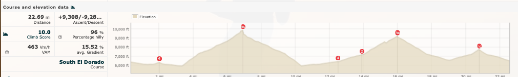
Map and profile via Runalyze
Obviously this didn't go as intended, which I attribute about 20% to not being prepared and 80% to weather. I should have taken more time to really recon the course and realize that the approach to Pyramid was iffy I would have been more ready for it and felt better when I hit the top. On the other hand, if the weather hadn't been as bad, I would have been a lot more comfortable at the top and more willing to try to find my way down the back half of Pyramid. As it is, I think I made the right decision not to go it alone, especially in light of how rainy it got later. I have good gear and experience in the mountains so I think I would have been fine, but being out that far alone[1] in bad weather is no fun. Moreover, while I did want to do an adventure run, this was primarily a training exercise and a strategy checkout, and from that perspective, it didn't matter that much which sections of the trail I ran.
Other than course recon, I was prepared pretty well. I had the right gear—though if I had kept going around the loop I might have been pretty sad about not having my rain pants and rain gloves—and everything worked well. I did get to try out some options and I've now concluded that the "pull the jacket over the pack" thing isn't going to work so I'll be going back to a normal sized zip-up jacket. Based on this experience I'm not planning to race in the Ultra 3s: the traction on the Sense Ride 5s is better and I like having the more modern bouncy foam instead of the more solid Ultra 3 foam; Salomon seems to have really dialed in the ride now on the newer foam so it feels stable and yet bouncy.
Fitness wise, this actually went quite well. This is an absurd amount of vert over 22 miles, over 25% more than Teanaway and UTMB. Obviously it's not as long as either, but feeling like I'm not even really that tired at 22 miles and 10 hrs is about what I would want. Usually after something this long I would be like "when will I be done" but this time I had to really restrain myself from going all the way to the summit on the second lap.
Overall: 22.7 mi, 9308 ft, 9:48:52
And I do mean alone. I only saw three people on the trail the whole day, at the top of Pyramid. ↩︎