Tenaya Loop Adventure Run Report
Posted by ekr on 16 Sep 2021
TL;DR. A great adventure run loop through Yosemite with amazing views.
My training partner Chris Wood and I were scheduled to run Tahoe 100K and Pine to Palm 100 miles respectively last weekend, but both races were canceled (thanks, forest fires!). Rather than revector to last minute races, we decided to do an "adventure run" (runner jargon for a long self-supported run) in Yosemite on a route pioneered by former ultrarunning and current FKT star Leor Pantilat
This was harder than we expected, and in particular the climb out of Yosemite Valley is incredibly difficult. We decided to skip the North Dome section because the trail was kind of faint and we were worried that we didn't want to be out there on an unfamiliar trail in the dark (remember, this isn't marked ever 200 meters like an ultra), so we detoured out to Tioga road and ran it on that. Still, we finished generally feeling fine, so mission accomplished.
Logistics #
Yosemite has restricted access: you need a reservation even to come in for the day and can only be in the park between 5 AM and 11 PM. Fortunately, passes are good for three days and we were able to get one for Thursday September 9 which meant we could use it for Saturday. It's actually a little unclear what kind of pass you need because Yosemite is set up for either day hiking or overnight and the overnight reservations depend on where you plan to camp, which we weren't doing, so I ended up calling a ranger who said that we just needed a day pass even if we were there past 11 and that we should leave a note on our car that we weren't staying.
I realized on Thursday that my poles ( Black Diamond Carbon Distance Z) were broken when I took them out for an equipment check. One segment of the pole retracts into the handle for storage and there's a metal locking pin that pops out when you extend it to keep it stable in use. The pin on one of my poles had rusted shut and wouldn't pop out no matter how much we sprayed WD-40 on it and tried to clean it off. Fortunately, the one REI in the area that had a pair was in Dublin so we were able to pick them up on the way. It sure would be nice if BD made this piece out of stainless steel so it was less likely to rust.
We drove out to Yosemite on Friday night and stayed at a hotel just outside the park. It's about 70-80 minutes from the hotel to the trailhead but we'd underestimated how close we were to the park and ended up arriving at the entrance around 4:35. Out of an abundance of rule following -- which we discovered later was unwarranted -- we waited till 5 AM to actually enter the park. This is obviously the effect they are going for as you have to actually "self-certify" your arrival at a given time, whereas with (say) the Grand Canyon you can just drive in whenever. We got to trailhead around 6 It takes a little while to prep everything at the start (get your shoes on, use the bathroom, etc.) so we finally got on the trail at around 6:50.
Start to Nevada Falls (0-12 miles, +2192/-4121 ft, 3:18) #
The first long stretch is on the Clouds Rest trail out to the John Muir Trail. This includes a climb to the highest point of the day at around 9700 ft, but you start at around 8200 ft, so it's not that big a deal. We actually got off course here a bit and skipped Clouds Rest but didn't realize it at the time (I just noticed writing this up).
This is followed by a long descent to the John Muir Trail (JMT) and down to Nevada Falls. Once you pick up JMT, things start to get pretty busy, especially once you get past the intersection to the Half Dome Trail.[1] Half Dome requires a special permit because it's so congested and we didn't have one, and we probably didn't have time to do it today. Once we had passed the junction we saw a bear amble across the trail, which is kind of unusual this close to the Valley. The Yosemite bears won't really bother you if you don't surprise them, so we just made some noise and kept going.
Nevada Falls to the Valley (12-24 miles, +2388ft/4183ft, 3:31) #
At this point we made our first major navigational error: JMT takes you straight from Nevada Falls into Yosemite Valley but Pantilat's route takes you up the Panorama Cliff trail. I had the route on my watch and it takes you a little way down -- presumably to get a view of the Valley and Vernal Falls -- JMT so we got confused and went about a half mile (and down 200 ft!) down before I realized we were off route. This required us to backtrack uphill to get back to Panaroma.
Panorama is a much more demanding route. There's a long climb which is actually quite good footing and non-technical which takes up you to Glacier Point (also incredibly busy) and then down 4 mile trail to the Valley itself. This is a giant descent (~4000ft) that's mostly runnable but pretty rocky so you had to kind of jog it rather than push the pace. At this point things were starting to get warm and we just barely had enough fluid to make it down the Valley.
We got to the Valley floor and crossed the Merced and thought about stopping and refilling our bottles but figured there had to be some sort of running water that wouldn't require filtering (see below for more on the filtering thing). As we crossed Northside Drive we found an information booth and asked where we could get some water and the woman staffing the booth pointed us at the Yosemite Lodge. She looked pretty skeptical when we told her we were headed up towards Yosemite Point ("It's very strenuous") but as we were already 24 miles in at this point we felt pretty confident. In any case, we hiked over to the lodge (the Valley itself is flat but it was so hot we ended up walking it anyway) and there was indeed a bathroom and a water tap but there was a mask requirement but we only had one mask so the whole process of filling our bottles took a long time (maybe 20 minutes?). This is partly just a matter of it taking time to go to the lodge and then the cumbersome filling process, but also once once of us had to sit and wait the while thing just kind of became an extended aid station. A good reminder not to sit down if you want to make good time.
The Valley to Yosemite Point (24-33.5, +4564/-1181 ft, 4:46) #
We then headed to Camp 4 for the start of the climb and realized we'd made a mistake going to the lodge because Camp 4 has bathrooms with running water and we could have saved a lot of time. This is of course partly a communication problem with the information booth but also my bad for not doing more research about where the water was. I had mostly been focused on where there were streams but just sort of assumed it would be easy to find water in the Valley.
The climb up to Yosemite Point was indeed difficult. There are two main climbs, one that's 1.3 miles and 1125 ft and another that's 1.2 miles and 2041 ft (followed by a bonus easy 1.3 miles and 453 ft). The two main ones are incredibly rocky, but at least mercifully shaded. At the end of the first one there's a brief downhill where we crossed paths with some hikers who had just done El Capitan and were worried they were on the wrong route. We told them they were and asked about the rest and they said something to the effect of "the next climb is horrendous" (true words!). Even with poles this was all a tremendous slog, really long and steep and mostly over rocky steps and we were certainly glad to be at the top.
Garmin's "ClimbPro" feature was really helpful here as it shows how long the climb you are on is and so gives you a sense of how you are doing. The GPS itself did go kind of haywire on the second climb and it kept telling us we had .47 to go for maybe 10 minutes, but eventually it worked itself out.
Once we reached the summit we started getting a little concerned: it was getting kind of late, we were low on fluid, and we were already about 10 hrs in with 11 miles of reasonably hard work to go. Fortunately, we soon got to Yosemite Falls and even though there wasn't much in the way of falls there was some semi-stagnant water below the bridge and we were able to fill our bottles. However, as we pushed on to Yosemite Point the trail started to really fade out and we got off trail several times. Sunset is around 7:00 in Yosemite this time of year and we were really unenthusiastic about trying to find out way in sketchy trail we didn't know purely by headlamp, so we decided to cut off the loop to North Dome and head straight to the road via the Porcupine Creek trail.
Yosemite Point to Finish (33.5-41.5, +1024/-663 ft, 2:04) #
The good news is that the trail to the road (3.1 miles) is quite clear and we were able to use Gaia GPS to figure out whether we were on track. We made pretty good time in this section and ran some of the flat/downhill sections.
Early on in this segment we ran into a woman who was doing a virtual Tahoe 200 (the actual race was cancelled because of the fires) and was heading in for a segment. We asked her what she was doing about the permits because she was going to be out overnight and also had crew and she said she'd just called the rangers and explained the situation and they had said not to worry; that's what we should have done rather than being all nitpicky about not starting before 5. She asked about water and we told her Yosemite Falls was good and then we kept going.
By the time we hit the road we were definitely a bit tired so we sat for a few minutes to eat and lighten our bottles. Now that it had gotten cool we were both carrying way too much fluid, so we went down to about a liter each for the final bit. I was also starting to get a bit nauseated at this point and while I never vomited I wasn't really that enthusiastic about more Tailwind or water. It took about 90 minutes of driving before I stopped feeling nauseated.
The last 5 miles or so were on the road. Initially we weren't sure how long it was because Gaia GPS wants to route straight but then we realized our Garmins would route us. It was also at this point that we realized we had another 700 feet of climbing between us and the finish followed by a mile and a half descent. To be honest, this part was pretty bad: we were both quite tired and it was starting to get dark. The road is narrow and even with bright headlamps so cars can see you it's pretty nervewracking to see them coming right at you and not be sure if they are going to swerve. The climb itself wasn't that bad, but at this point in the event my feet and legs start to hurt and so running the downhill is actually an exercise in forcing yourself to push through (good practice, though). I was drinking a little bit but figured it didn't matter too much because I could make it all the way without much at all.
Eventually we could see the signs for the trailhead and sort of arbitrarily picked the point on the road where you go into the parking lot, stopped, and walked the remaining 100 yards or so to the car.
Retrospective #
Overall this went well. We finished in good order without either of us really cratering or it turning into a horrible death march.
I think we did pretty well on pace. We might have been able to push the early climbs a bit harder (the later ones were just a matter of survival) and I think we could have run a few of the flatter climbs, but overall we finished pretty tired. A lot of the descents were really slow because we were worried about crashing, in part because I had had a really bad fall about 3 weeks before and was worried about another one before I was completely recovered.
Nutrition went reasonably well for most of this: I brought Tailwind and Powerbars and aimed for 500ml Tailwind and 1/2 Powerbar every hour (~300 cal), which I mostly did by just figuring I was going about 15 min/mile. As noted above, the Tailwind started to become a bit of a problem towards the end but I was still comfortable with Powerbars. In retrospect, I wish that I had brought some salty snacks for the last half: I'm used to them just being available at races, but of course here we had to carry our own stuff.
Our planning/logistics could have been better. If we'd gotten to the park at 3:30 or so and started at 5, we would have had a lot more daylight and would have been more comfortable with doing the whole loop. Obviously we were tired, but the clinching reason for me was worrying about getting lost or just finishing super-late. If I'd called the rangers and cleared this, then I would have been a lot more comfortable, but I got kind of worried about the threat of huge fines and so that kept us back.
I also wish I'd had a better sense of the route. We got off course a few times before I decided to set the "off course" alarm (I was worried about battery consumption) which cost time, and if I'd known the route better, that wouldn't have happened. Instead I was just relying on the GPS, which was a mistake, especially as it included some of Pantilat's detours to take photos, etc. Second, this meant I didn't really know where there was water and the like, which cost us time in the Valley but also just meant I was nervous a lot of the time about whether we would have enough (in the event, this was not an issue). We were both using the Salomon XA filter cap on our bottles which works great. When you get to a water source you can just quickly fill the bottle and drink and then refill it, so you're already a liter up, plus it's relatively easy to squeeze it into a different bottle if you want to have more than that. Alternately, you can just fill another bottle with unfiltered water and remember that it's now contaminated. We were each carrying 5 bottles (2.5 liters) and we never needed more capacity than that. It's a little bit of a pain to fill with Tailwind in these case, but never that big a deal.
I wore the Salomon Sense Pro 4 for this and they worked out reasonably well, though my ankle started to hurt a bit towards the very end. I might have been better with my S/LAB Ultra 3 which are a bit more built up though slightly (~35g) heavier and are a little more supportive on this kind of tricky terrain (also, the lace garage is at the bottom so the laces never come out unlike the Sense Pros).
As noted above, I'd had a really bad fall coming down Kennedy Road a few weeks before and it had left one of the ribs on my left side incredibly sore. I'd mostly trained through it and it had gotten a lot better by this time, but it was still sore and I was worried it would be a problem, especially with having to use my upper body for the poles. It was actually mostly fine, though.
Overall time: 41.4 mi, 10164ft, 13:39:49
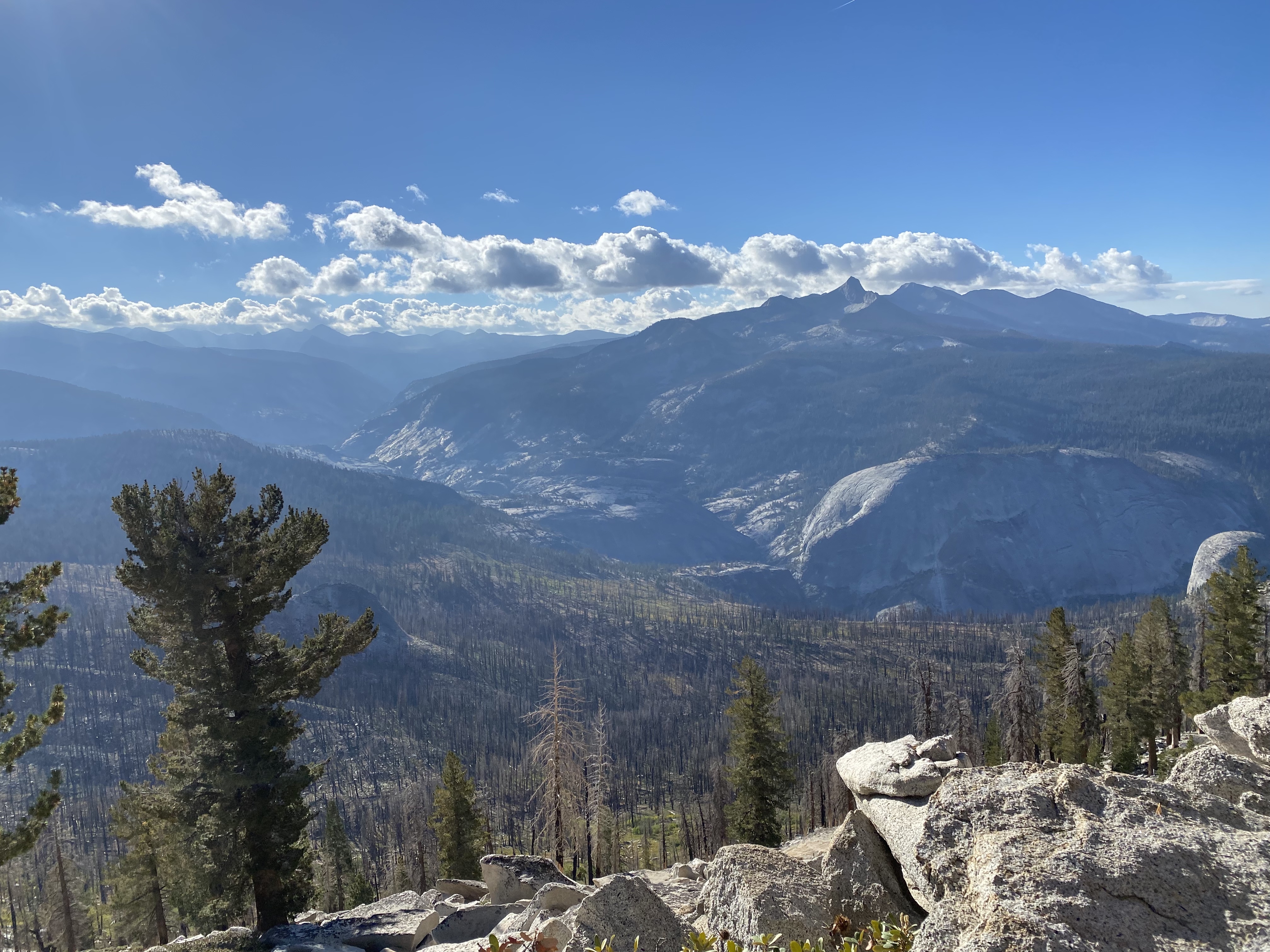
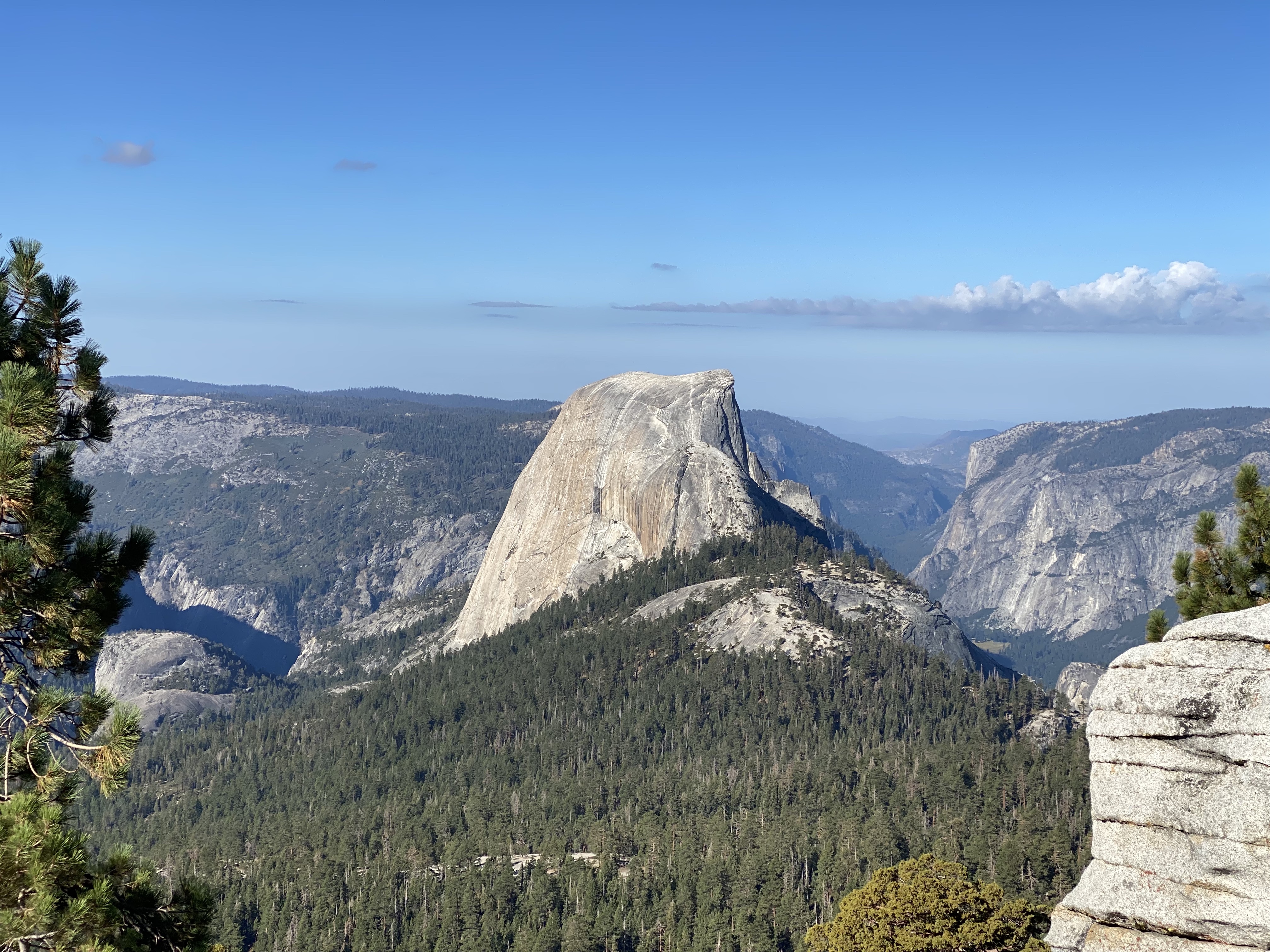
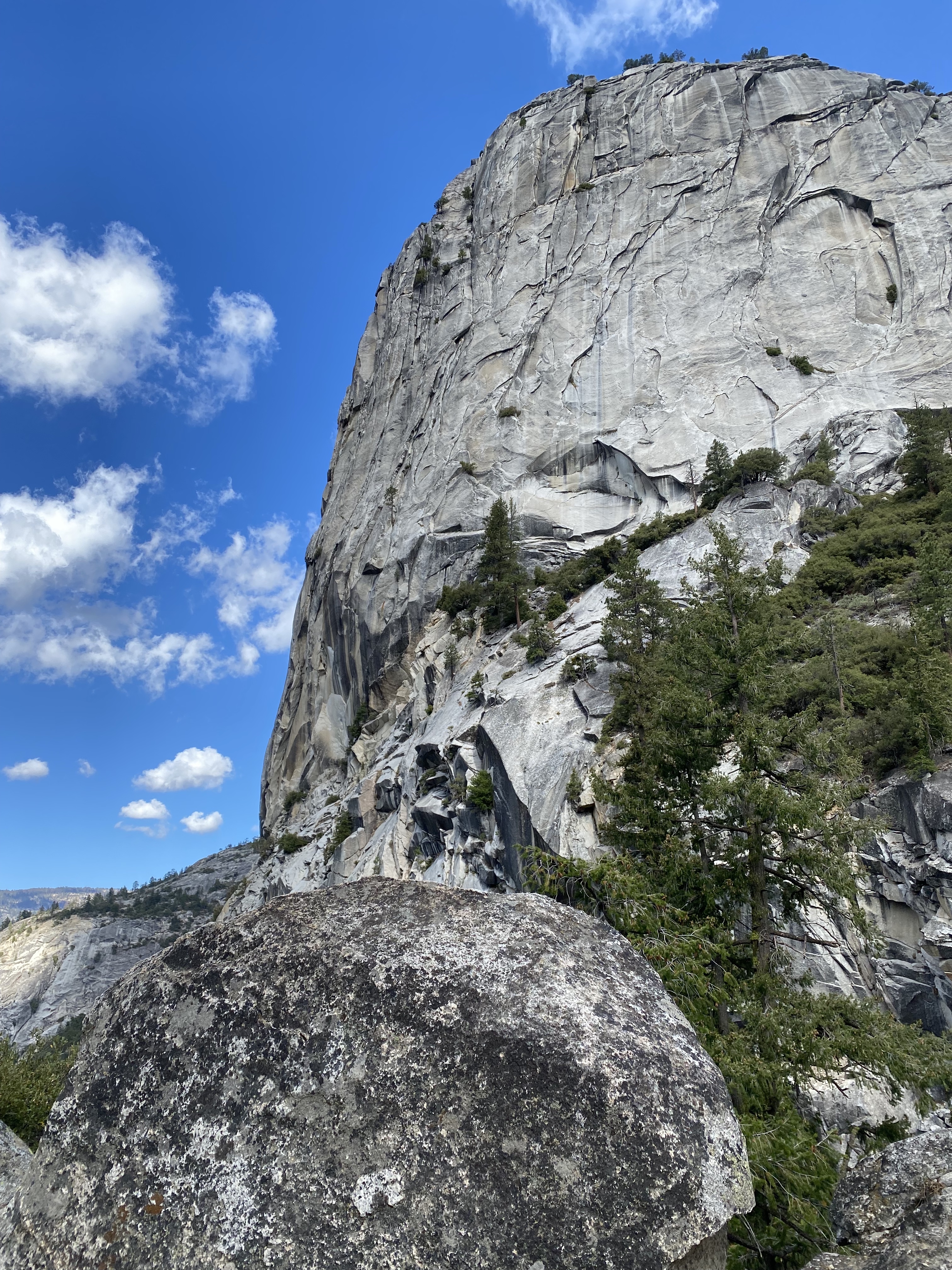
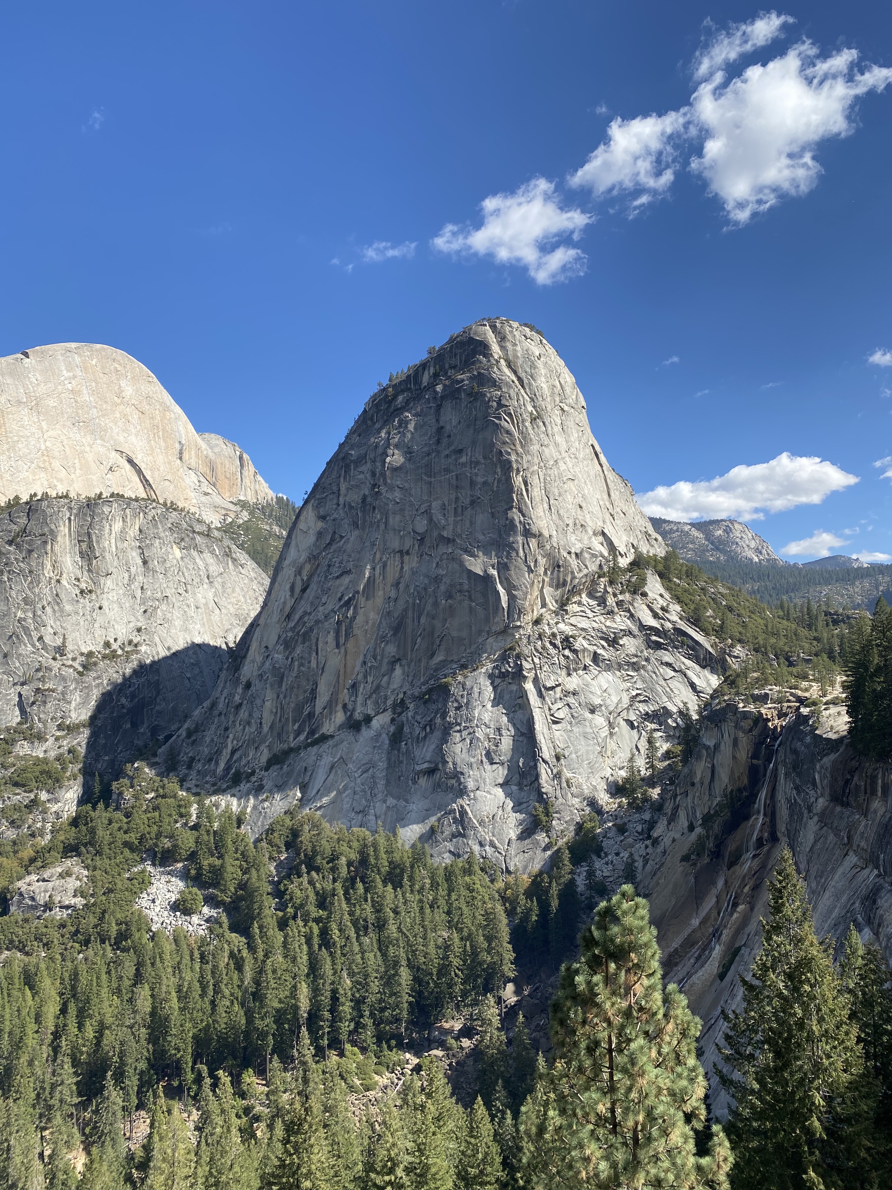
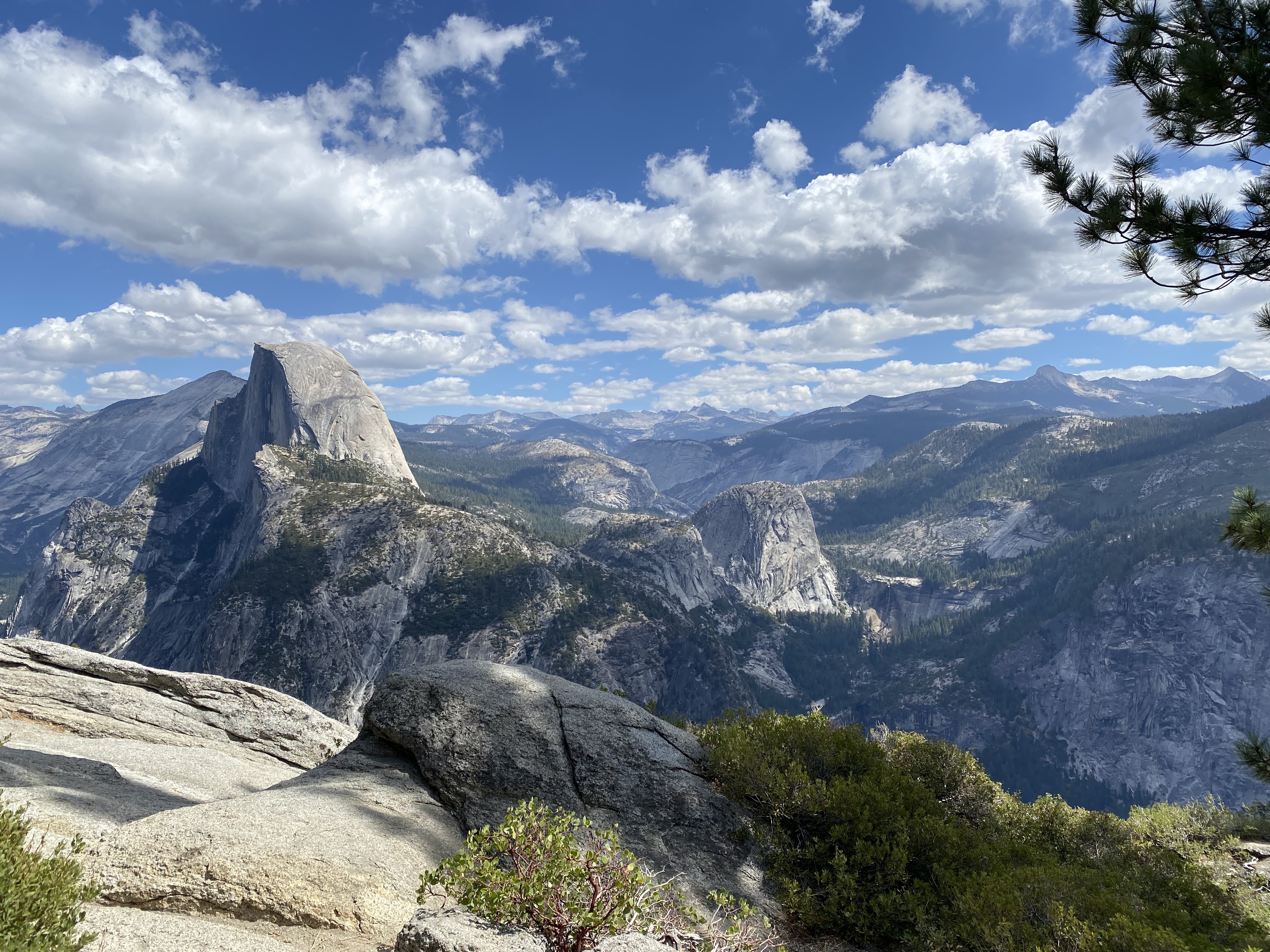
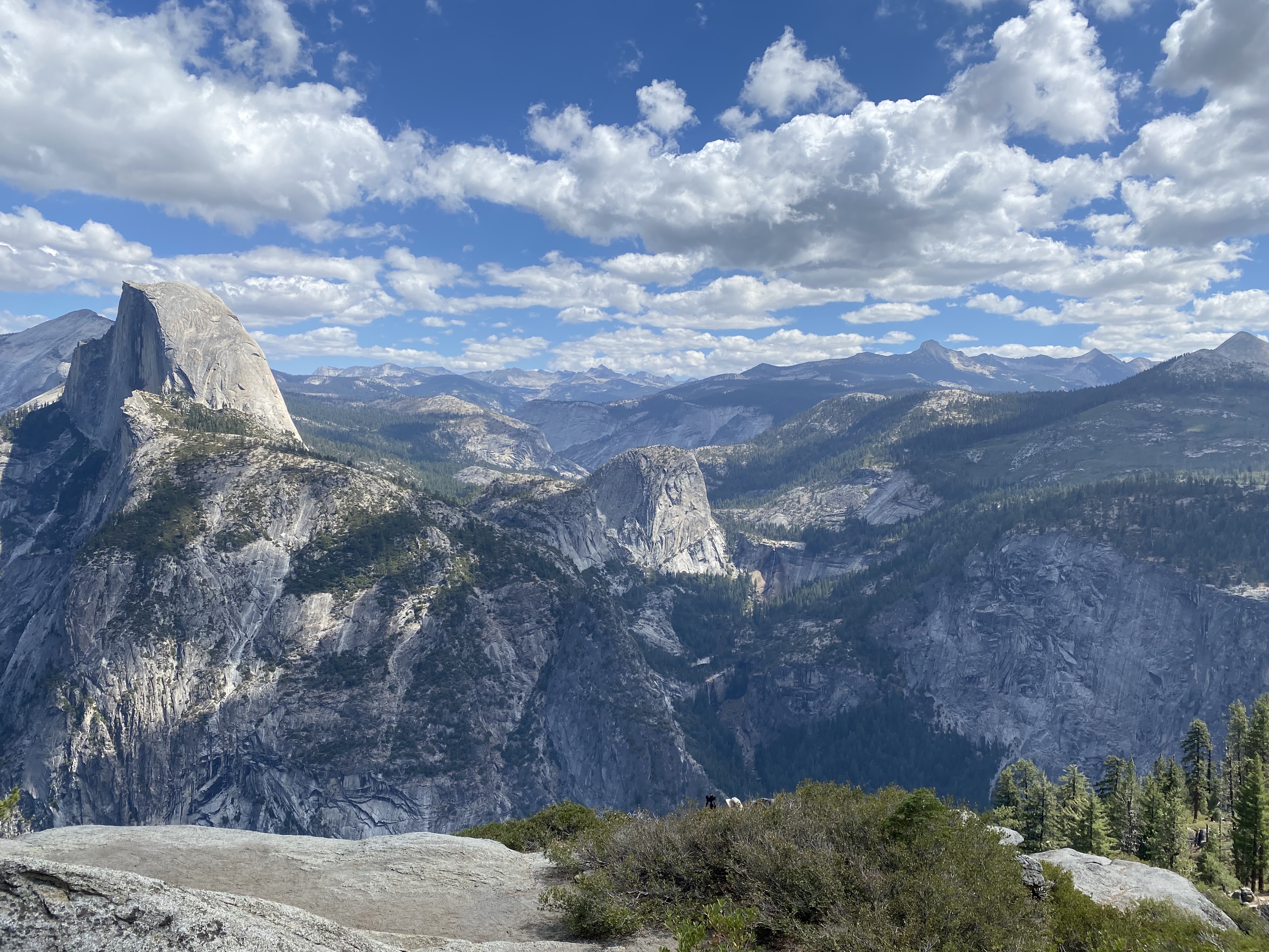
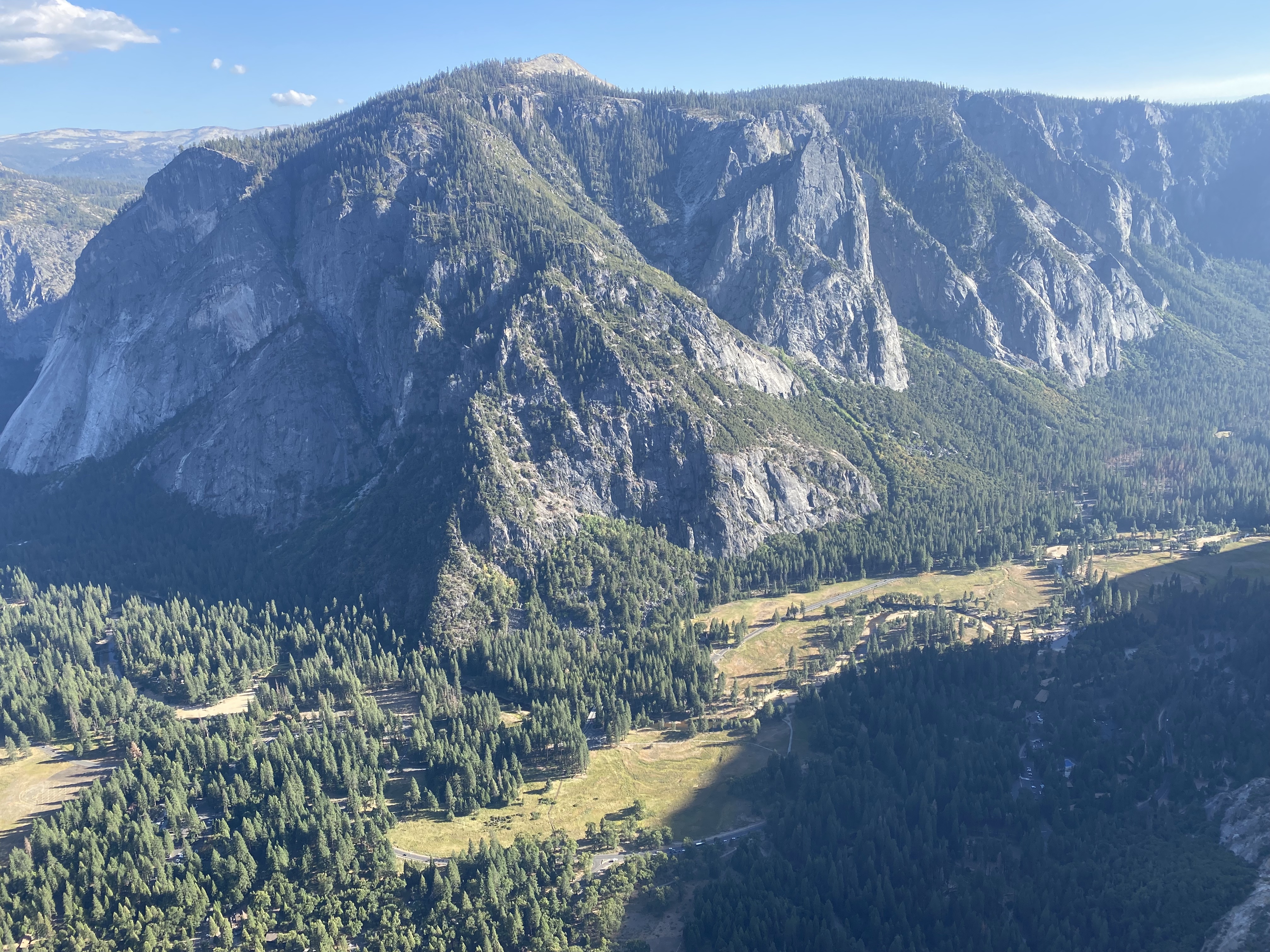
Pictures #
Here are the best of the picture Chris took during the run. I took a few as well, but they're mostly duplicative, so I'm just using his.